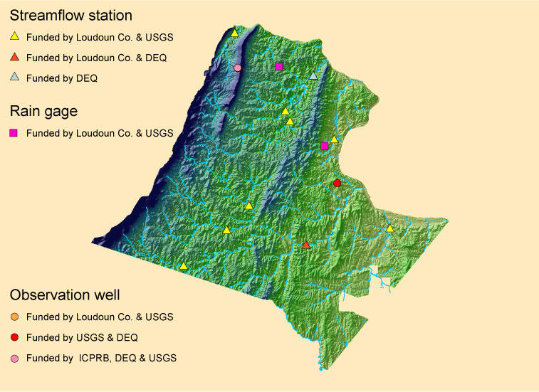
Surface-water stage and discharge are measured at ten gaging stations in Loudoun County by the U.S. Geological Survey and the Virginia Department of Environmental Quality. Currently, data are available on-line for all ten of the sites and is updated in "near real-time" .Ground-water levels are measured in two wells in Loudoun County by the U.S. Geological Survey. Currently, data are available on-line for both wells; with data for one well being reported "near real-time". Water levels in the other well are measured periodically and are updated near the end of each month (when data are available).
Rainfall data is collected at two locations in Loudoun County by the U.S. Geological Survey. Currently, data are available on-line for these sites. Historical data for several rainfall monitor sites in the County are available from the County.
Click on a site on the map to view graph(s) and other data for the station.
Note: Current data are provisional.
Water Year Stream Flow Data.
(.76 MB PDF file)
(download ADOBE
PDF reader here)
Return to Loudoun County Water Resources Investigation Home Page
Contact: GS-W-VArmd_webmaster@usgs.gov
U.S. Department of Interior,
U.S. Geological Survey
Privacy Statement
Disclaimer
Accessibility
URL://va.water.usgs.gov/Loudoun/data.htm
April 02, 2008 08:49