|
|
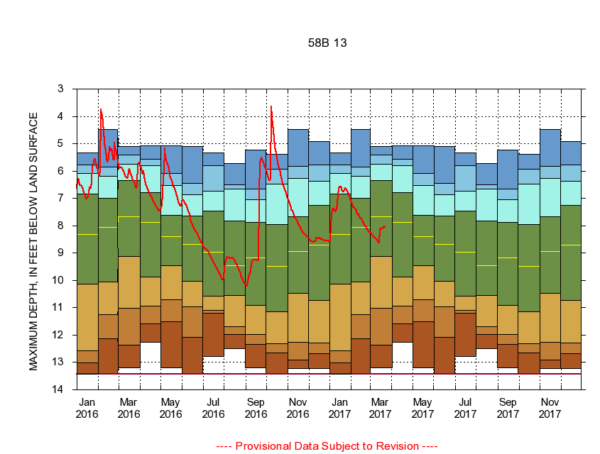
363928076332901 58B 13
|
|
|
LOCATION.--Latitude 36°39'28", Longitude 76°33'29", North American Datum of 1927
Suffolk City, Va., Hydrologic Unit 03010205.
|
|
|
WELL CHARACTERISTICS.--Well is located in Columbia aquifer of Quaternary age. Depth 15 ft.
|
|
|
PERIOD OF RECORD.--Continual data, January 1981 to current year. Periodic data, March 1975 to current year.
|
|
|
DURATION STATISTIC COMPUTATION PERIOD.--All continual data through September 2015, all approved periodic data.
|
|
|
EXTERNAL INFLUENCE.--No known external influences.
|
|
|
GAGE OPERATION.--Virginia Department of Environmental Quality - Water Division.
|
|
|
|