|
|
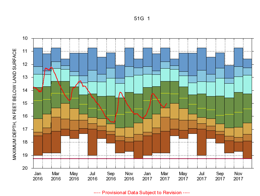
371644077244601 51G 1
|
|
|
LOCATION.--Latitude 37°16'44", Longitude 77°24'46", North American Datum of 1927
Colonial Heights City, Va., Hydrologic Unit 02080207.
|
|
|
WELL CHARACTERISTICS.--Well is located in Petersburg Granite of Mississippian age. Depth 100 ft.
|
|
|
PERIOD OF RECORD.--Continual data, July 2006 to current year. Periodic data, October 1939 to November 2000, June 2001 to current year.
|
|
|
DURATION STATISTIC COMPUTATION PERIOD.--All continual data through September 2015, all approved periodic data.
|
|
|
EXTERNAL INFLUENCE.--No known external influences.
|
|
|
GAGE OPERATION.--U.S. Geological Survey, Virginia Water Science Center.
|
|
|
|
|