|
|
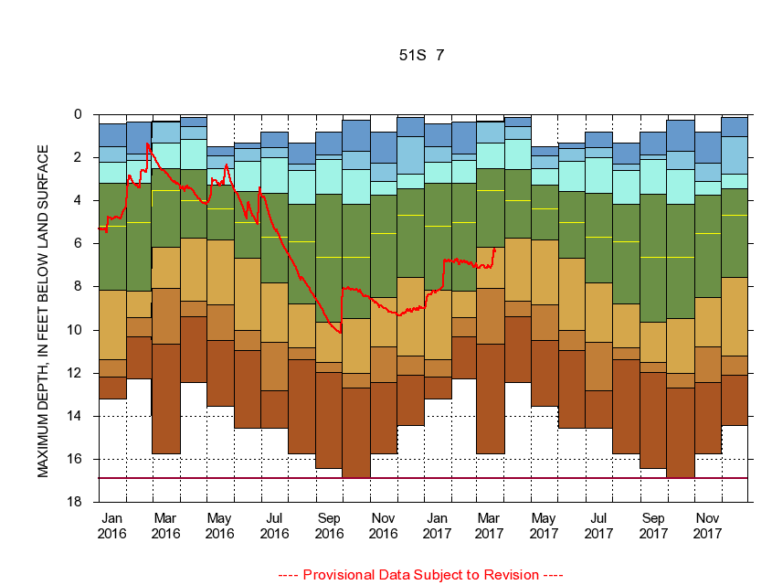
383423077245901 51S 7
|
|
|
LOCATION.--Latitude 38°34'23", Longitude 77°24'59", North American Datum of 1927
Prince William County, Va., Hydrologic Unit 02070011.
|
|
|
WELL CHARACTERISTICS.--Well is located in Lunga Reservoir Formation of Cambrian age. Depth 490 ft.
|
|
|
PERIOD OF RECORD.--Continual data, August 1984 to current year. Periodic data, September 1973 to November 1975, December 1977 to current year.
|
|
|
DURATION STATISTIC COMPUTATION PERIOD.--All continual data through September 2015, all approved periodic data.
|
|
|
EXTERNAL INFLUENCE.--No known external influences.
|
|
|
GAGE OPERATION.--U.S. Geological Survey, Virginia Water Science Center.
|
|
|
|
|