|
|
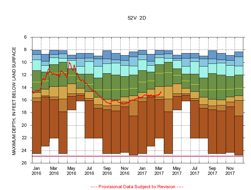
385638077220101 52V 2D
|
|
|
LOCATION.--Latitude 38°56'58", Longitude 77°22'01", North American Datum of 1927
Fairfax County, Va., Hydrologic Unit 02070010.
|
|
|
WELL CHARACTERISTICS.--Well is located in Manassas Sandstone of Triassic age. Depth 205 ft.
|
|
|
PERIOD OF RECORD.--Continual data, October 1995 to current year. Periodic data, October 1976 to current year.
|
|
|
DURATION STATISTIC COMPUTATION PERIOD.--All continual data through September 2015, all approved periodic data.
|
|
|
EXTERNAL INFLUENCE.--No known external influences.
|
|
|
GAGE OPERATION.--U.S. Geological Survey, Virginia Water Science Center.
|
|
|
|
|