Virginia Water Science Center
|
|
|
|
|
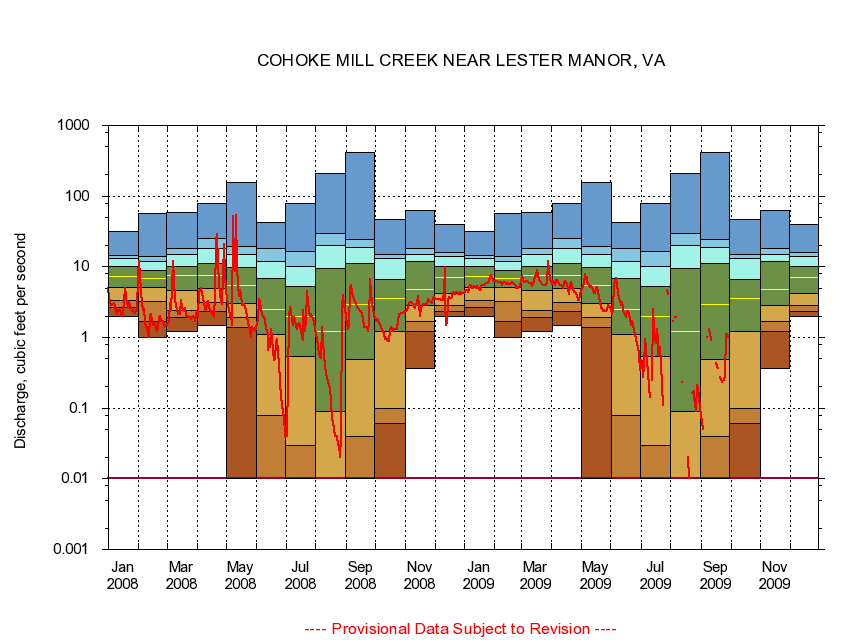
The current daily value for 09/30/2009 is not determined. 
|
|
|
||||||||||||||||||||||||||||||||||||||||||||||||||||||||||||||||||||||||||||||||||||||||||||||||||||||||||||||||||||||||||||||||||||||||||||||||||||||||||||||||||||||||||||||||||||||||||||||||||||||||||||||||||||||||||||||||||||||||||||||||||||||||||||||||||||||||||||||||||||

![]() U.S. Department of the Interior |
U.S. Geological Survey
U.S. Department of the Interior |
U.S. Geological Survey
URL: http://va.water.usgs.gov/duration_plots/daily/dp01673638.htm
Page Contact Information: Virginia
WSC Webmaster
Page Last Modified:
5/22/2009

