|
|
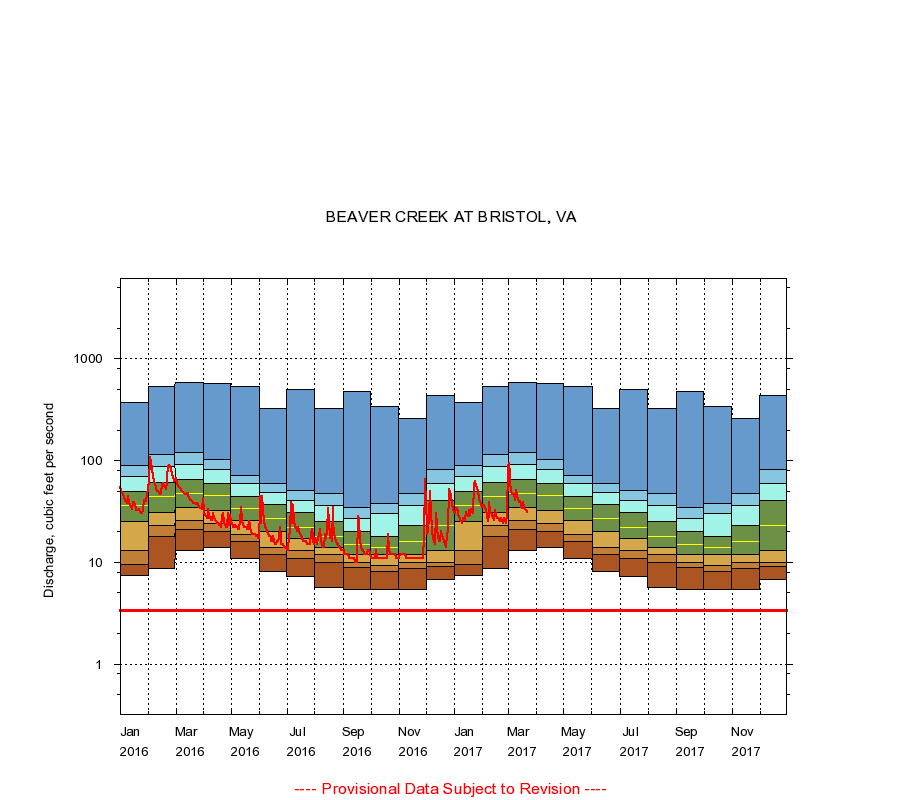
03478400 BEAVER CREEK AT BRISTOL, VA
|
|
|
LOCATION.--Latitude 36°37'54", Longitude 82°08'02", North American Datum of 1927,
Bristol City, VA, Hydrologic Unit 06010102.
|
|
|
DRAINAGE AREA.--26.9 square miles.
|
|
|
PERIOD OF RECORD.--July 1957 to current year. Published as "near Bristol" prior to October 1974.
|
|
|
DURATION STATISTIC COMPUTATION PERIOD.--All data through September 2015.
|
|
|
REGULATION.--Some small diurnal fluctuation at low flow caused by plant upstream.
|
|
|
GAGE OPERATION.--U.S. Geological Survey, Virginia Water Science Center.
|
|
|
|