|
|
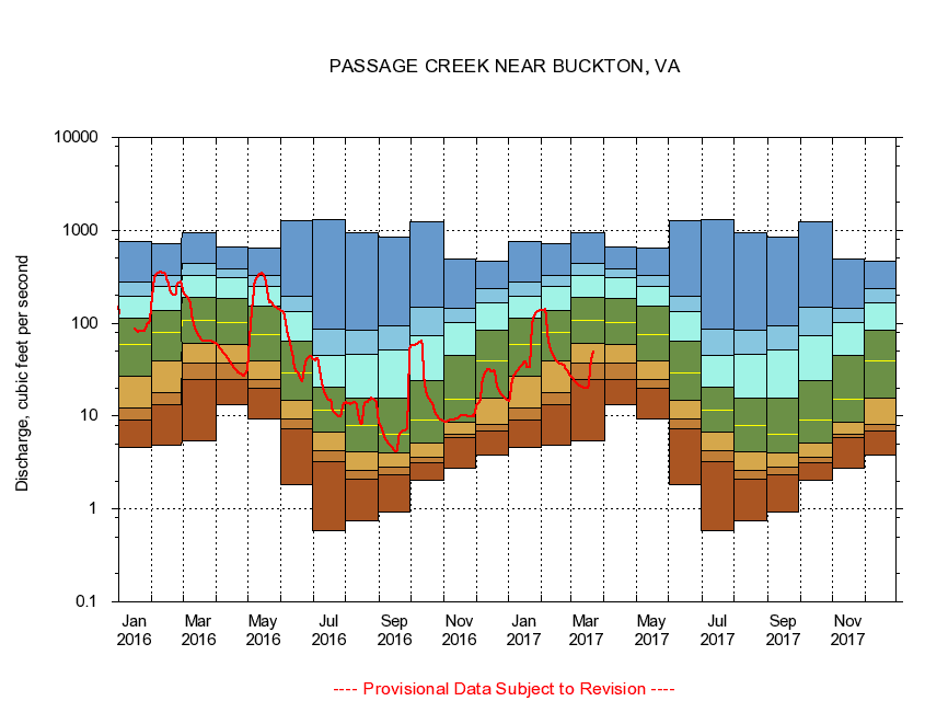
01635500 PASSAGE CREEK NEAR BUCKTON, VA
|
|
|
LOCATION.--Latitude 38°57'29", Longitude 78°16'01", North American Datum of 1927,
Warren County, VA, Hydrologic Unit 02070006.
|
|
|
DRAINAGE AREA.--86.5 square miles.
|
|
|
PERIOD OF RECORD.--October 1905 to July 1906 (gage heights only), April 1932 to current year. Prior to October 1966 published as "at Buckton."
|
|
|
DURATION STATISTIC COMPUTATION PERIOD.--All data through September 2015.
|
|
|
REGULATION.--Some regulation at low flows from operation of State Fish Hatchery 2 miles above station. At a point 14.2 miles upstream from gage on Little Passage Creek, there was a diversion at times of about 0.36 cfs (1991).
|
|
|
GAGE OPERATION.--Virginia Department of Environmental Quality - Water Division.
|
|
|
|