|
|
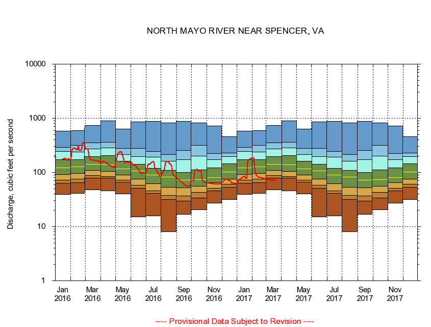
02070000 NORTH MAYO RIVER NEAR SPENCER, VA
|
|
|
LOCATION.--Latitude 36°34'05", Longitude 79°59'15", North American Datum of 1927,
Henry County, VA, Hydrologic Unit 03010103.
|
|
|
DRAINAGE AREA.--108 square miles.
|
|
|
PERIOD OF RECORD.--October 1928 to current year. Monthly discharge only for some periods, published in WSP 1303.
|
|
|
DURATION STATISTIC COMPUTATION PERIOD.--All data through September 2015.
|
|
|
REGULATION.--No known regulation.
|
|
|
GAGE OPERATION.--Virginia Department of Environmental Quality - Water Division.
|
|
|
|