|
|
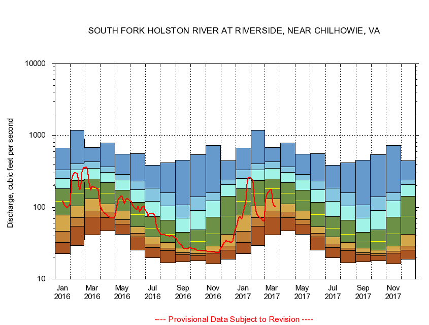
03471500 SOUTH FORK HOLSTON RIVER AT RIVERSIDE, NEAR CHILHOWIE, VA
|
|
|
LOCATION.--Latitude 36°45'37", Longitude 81°37'53", North American Datum of 1927,
Smyth County, VA, Hydrologic Unit 06010102.
|
|
|
DRAINAGE AREA.--76.6 square miles.
|
|
|
PERIOD OF RECORD.--October 1920 to December 1931, July 1942 to current year. Monthly discharge only for some periods, published in WSP 1306. Prior to October 1924, published as "near Chilhowie." June 1907 to December 1909, at site 4.5 mi downstream also published as "near Chilhowie"; records not equivalent.
|
|
|
DURATION STATISTIC COMPUTATION PERIOD.--All data through September 2015.
|
|
|
REGULATION.--Some diurnal fluctuation caused by mill prior to 1951.
|
|
|
GAGE OPERATION.--U.S. Geological Survey, Virginia Water Science Center.
|
|
|
|
|