|
|
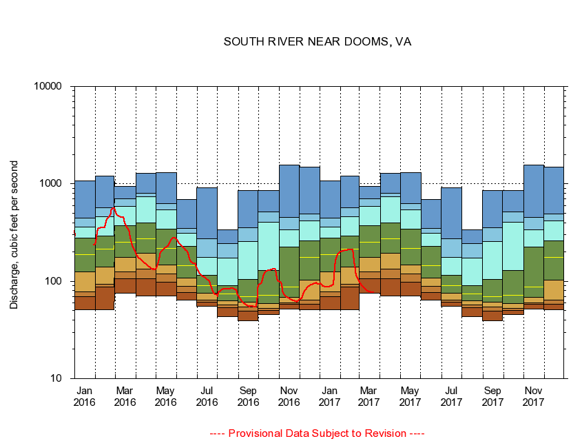
01626850 SOUTH RIVER NEAR DOOMS, VA
|
|
|
LOCATION.--Latitude 38°05'19", Longitude 78°52'38", North American Datum of 1927,
Waynesboro City, VA, Hydrologic Unit 02070005.
|
|
|
DRAINAGE AREA.--148 square miles.
|
|
|
PERIOD OF RECORD.--April 1974 to September 1996, 2005 to current year.
|
|
|
DURATION STATISTIC COMPUTATION PERIOD.--All data through September 2015.
|
|
|
REGULATION.--Discharge for industrial plant, 2.6 mile upstream, originating from well fields, adds about 6.0 cfs. Wastwater treatment upstream estimated input 12.6 cfs.
|
|
|
GAGE OPERATION.--Virginia Department of Environmental Quality - Water Division.
|
|
|
|
|