|
|
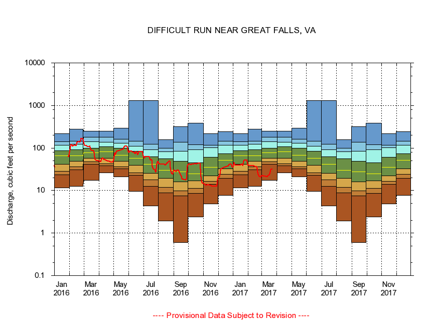
01646000 DIFFICULT RUN NEAR GREAT FALLS, VA
|
|
|
LOCATION.--Latitude 38°58'33", Longitude 77°14'46", North American Datum of 1927,
Fairfax County, VA, Hydrologic Unit 02070008.
|
|
|
DRAINAGE AREA.--57.8 square miles.
|
|
|
PERIOD OF RECORD.--October 1934 to current year. Monthly discharge only October to December 1934, published in WSP 1302.
|
|
|
DURATION STATISTIC COMPUTATION PERIOD.--All data through September 2015.
|
|
|
REGULATION.--No known regulation.
|
|
|
GAGE OPERATION.--Virginia Department of Environmental Quality - Water Division.
|
|
|
|