|
|
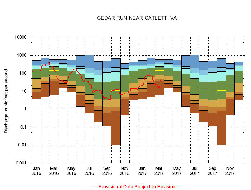
01656000 CEDAR RUN NEAR CATLETT, VA
|
|
|
LOCATION.--Latitude 38°38'12", Longitude 77°37'31", North American Datum of 1927,
Fauquier County, VA, Hydrologic Unit 02070010.
|
|
|
DRAINAGE AREA.--93.4 square miles.
|
|
|
PERIOD OF RECORD.--July 1950 to December 1986, January 1986 to September 1989 (annual maximum only), October 1989 to current year.
|
|
|
DURATION STATISTIC COMPUTATION PERIOD.--All data through September 2015.
|
|
|
REGULATION.--No known regulation.
|
|
|
GAGE OPERATION.--Virginia Department of Environmental Quality - Water Division.
|
|
|
|