|
|
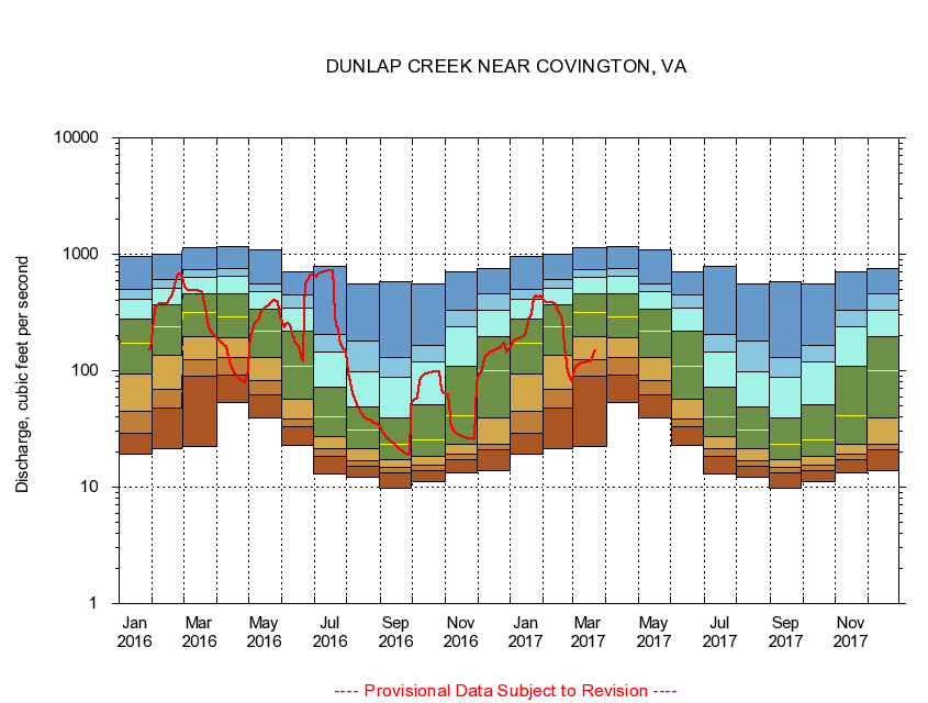
02013000 DUNLAP CREEK NEAR COVINGTON, VA
|
|
|
LOCATION.--Latitude 37°48'10", Longitude 80°02'50", North American Datum of 1927,
Alleghany County, VA, Hydrologic Unit 02080201.
|
|
|
DRAINAGE AREA.--162 square miles.
|
|
|
PERIOD OF RECORD.--October 1928 to current year. Monthly discharge only for some periods, published in WSP 1303.
|
|
|
DURATION STATISTIC COMPUTATION PERIOD.--All data through September 2015.
|
|
|
REGULATION.--Occasional diurnal fluctuation caused by the draining or filling of small dam located 7.9 miles upstream from the station.
|
|
|
GAGE OPERATION.--U.S. Geological Survey, Virginia Water Science Center.
|
|
|
|