Virginia Water Science Center
|
|
|
|
|
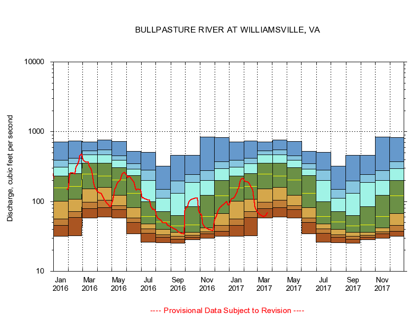
The current 28-day running-average value for 03/22/2017 is 68.54 cubic feet per second. 
|
|
|
||||||||||||||||||||||||||||||||||||||||||||||||||||||||||||||||||||||||||||||||||||||||||||||||||||||||||||||||||||||||||||||||||||||||||||||||||||||||||||||||||||||||||||||||||||||||||||||||||||||||||||||||||||||||||||||||||||||||||||||||||||||||||||||||||||||||||||||||||||

![]() U.S. Department of the Interior |
U.S. Geological Survey
U.S. Department of the Interior |
U.S. Geological Survey
URL: http://va.water.usgs.gov/duration_plots/htm_28/dp02015700.htm
Page Contact Information: Virginia
WSC Webmaster
Page Last Modified:
6/19/2016

