|
|
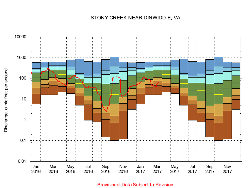
02046000 STONY CREEK NEAR DINWIDDIE, VA
|
|
|
LOCATION.--Latitude 37°04'01", Longitude 77°36'10", North American Datum of 1927,
Dinwiddie County, VA, Hydrologic Unit 03010201.
|
|
|
DRAINAGE AREA.--113 square miles.
|
|
|
PERIOD OF RECORD.--September 1946 to current year. Published as "at Dinwiddie" September 1946 to September 1947 and October 1949 to September 1950.
|
|
|
DURATION STATISTIC COMPUTATION PERIOD.--All data through September 2015.
|
|
|
REGULATION.--No known regulation.
|
|
|
GAGE OPERATION.--Virginia Department of Environmental Quality - Water Division.
|
|
|
|