|
|
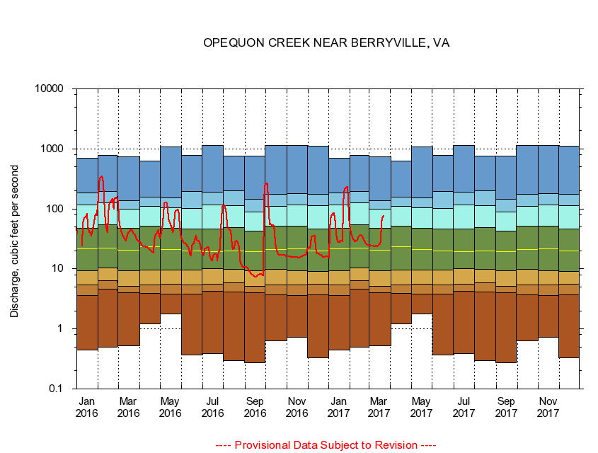
01615000 OPEQUON CREEK NEAR BERRYVILLE, VA
|
|
|
LOCATION.--Latitude 39°10'29", Longitude 78°04'42", North American Datum of 1983,
Frederick County, VA, Hydrologic Unit 02070004.
|
|
|
DRAINAGE AREA.--58.2 square miles.
|
|
|
PERIOD OF RECORD.--October 1943 to September 1997, October 2002 to current year.
|
|
|
DURATION STATISTIC COMPUTATION PERIOD.--All data through September 2015 except July 1988 through September 1997.
|
|
|
REGULATION.--Wastewater treament plant inflows from July 1988 through September 1997.
|
|
|
GAGE OPERATION.--U.S. Geological Survey, Virginia Water Science Center.
|
|
|
|