|
|
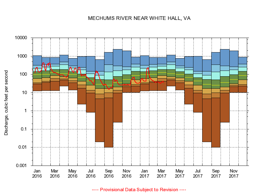
02031000 MECHUMS RIVER NEAR WHITE HALL, VA
|
|
|
LOCATION.--Latitude 38°06'09", Longitude 78°35'35", North American Datum of 1927,
Albemarle County, VA, Hydrologic Unit 02080204.
|
|
|
DRAINAGE AREA.--95.3 square miles.
|
|
|
PERIOD OF RECORD.--October 1942 to September 1951, October 1979 to current year. Prior to September 1951, published as Mechum River near Ivy.
|
|
|
DURATION STATISTIC COMPUTATION PERIOD.--All data through September 2015.
|
|
|
REGULATION.--No known regulation.
|
|
|
GAGE OPERATION.--Virginia Department of Environmental Quality - Water Division.
|
|
|
|