|
|
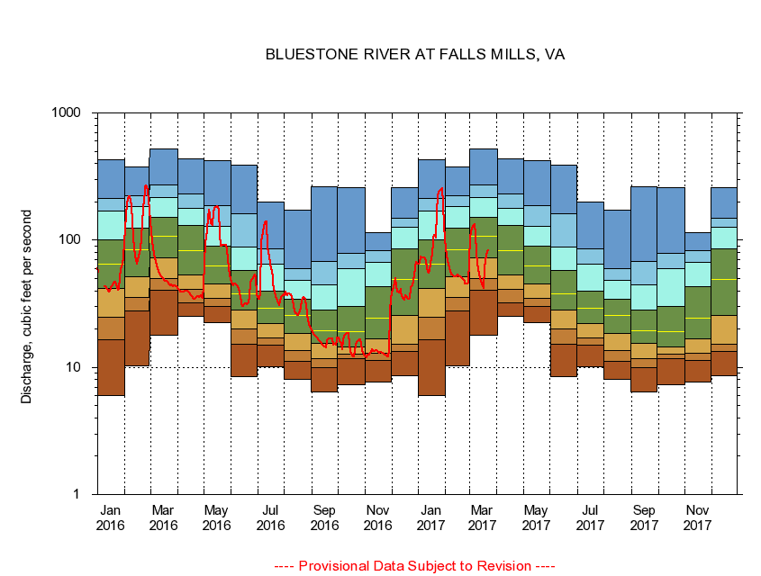
03177710 BLUESTONE RIVER AT FALLS MILLS, VA
|
|
|
LOCATION.--Latitude 37°16'17", Longitude 81°18'18", North American Datum of 1927,
Tazewell County, VA, Hydrologic Unit 05050002.
|
|
|
DRAINAGE AREA.--44.3 square miles.
|
|
|
PERIOD OF RECORD.--October 1980 to March 1997, October 2004 to current year.
|
|
|
DURATION STATISTIC COMPUTATION PERIOD.--All data through September 2015.
|
|
|
REGULATION.--Some diurnal fluctuation caused by discharge from wastewater treatment plant 2.3 mi. upstream. About 65 per cent of discharge from the treatment plant is diverted from another drainage basin.
|
|
|
GAGE OPERATION.--U.S. Geological Survey, Virginia Water Science Center.
|
|
|
|