USGS visual identity banner


National Water Monitoring Day
A "Snapshot" of the James River Watershed

Jamse River basin graphic
Water-quality data and maps
James River and Kanawha Canal James River near Richmond James River at Cartersville James River at Scottsville James River at Bent Creek James River at Holcomb Rock James River at Buchanan James River at Lick Run Jackson River below Danlap Creek Jackson River below Gathright Dam Jackson River at BacovaMonitoring Sites map bar chart thumbnail
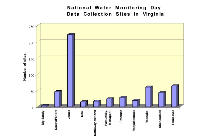
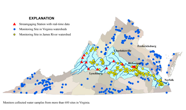
Monitoring sites by watershed


Year of Clean Water Logo

Water-quality data and maps from more than 200 samples from the James River Watershed. 

National Water Monitoring Day at Tredegar Iron Works

VA DCR logoVA DEQ logoIzaak Walton League logoJames River Association logoAlliance for Chesapeake Bay logoVirginia Water Monitoring Council logo Virginia Environmental Endowment logo


USGS--Water Resources of Virginia                                                

Contact: GS-W-VArmd_webmaster@usgs.gov
U.S. Department of Interior, U.S. Geological Survey
Privacy Statement
Disclaimer

URL://va.water.usgs.gov/wqday/vawqd.html      Last modified: 11/23/09 10:52:41 AM