|
|
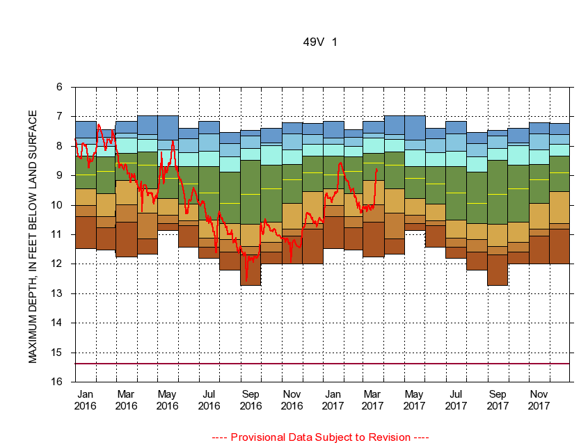
385607077381101 49V 1
|
|
|
LOCATION.--Latitude 38°56'07", Longitude 77°38'11", North American Datum of 1927
Prince William County, Va., Hydrologic Unit 02070010.
|
|
|
WELL CHARACTERISTICS.--Well is located in Turkey Run Formation of Early Jurassic age. Depth 165 ft.
|
|
|
PERIOD OF RECORD.--Continual data, June 1979 to current year. Periodic data, November 1968 to current year.
|
|
|
DURATION STATISTIC COMPUTATION PERIOD.--All continual data through September 2015, all approved periodic data.
|
|
|
EXTERNAL INFLUENCE.--No known external influences.
|
|
|
GAGE OPERATION.--U.S. Geological Survey, Virginia Water Science Center.
|
|
|
|
|