
| Hurricane Jeanne September 2004: Flood Magnitude | |
| Rappahannock and York River Basins | |
|
|
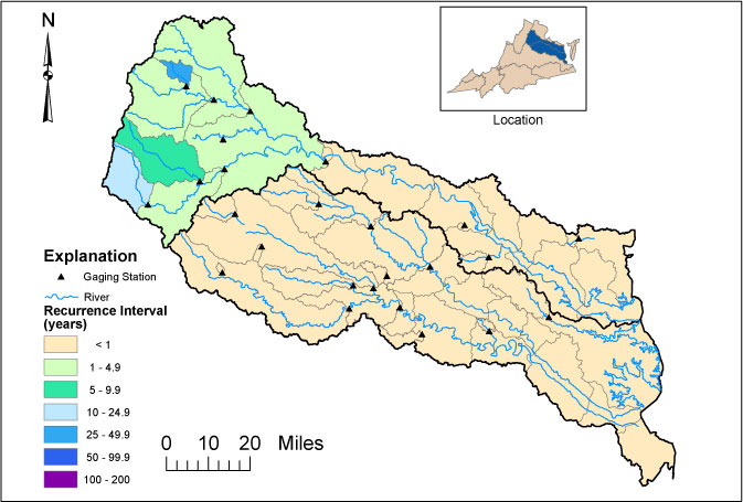
Scientists map the areal extents of floods and assign recurrence intervals using streamflow data collected by the USGS and the Virginia Department of Environmental Quality since the late 1800s. Recurrence intervals express the likelihood that an event, such as a flood, will occur in any given year. For example, a 100-year-flood has a 1% chance of occurring in any year, and a 25-year flood has a 4% chance of occurring in any year. |
|
|
USGS--Water Resources of Virginia Contact: GS-W-VArmd_webmaster@usgs.gov URL://va.water.usgs.gov/floodwatch/h_jeanne/v_rapyork_jeanne.htm Last modified: 09/30/04 01:02:28 PM |