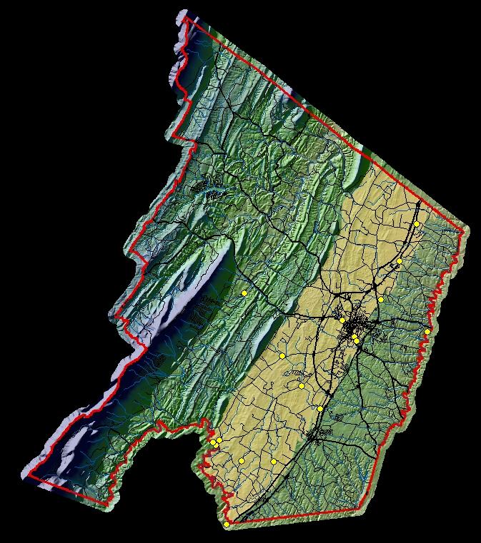
Surface-water stage and discharge are measured at five gaging stations in the Frederick County study area by the U.S. Geological Survey and the Virginia Department of Environmental Quality. Miscellaneous hydrologic data is also being collected at thirteen measuring stations. New miscellaneous stations have been established at Rouss Spring, Redbud Run above Fay Spring, and Hot Run tributary at Route 11 near Stephenson. Currently, data are available on-line for selected sites; stage and/or discharge are measured periodically or continuously via monitoring equipment. On-line data are updated near the end of each month (when data are available).Click on a site on the map to view graph(s) and other data for the station.
Note: Current data are provisional.
Designated carbonate study area derived from:
Rader, E.K., McDowell, R.C., Gathright, T.M., II,
and Orndorff, R.C., 2003, Raster image of the geologic map of the Virginia
portion of the Winchester 30 X 60 minute quadrangle: Virginia Division of
Mineral Resources Publication 171, Part A [CD-ROM; 2003, September 1].
Virginia Division of Mineral Resources, 2003, Digital geospatial data for the geologic map of the Virginia portion of the Winchester 30 X 60 minute quadrangle: Virginia Division of Mineral Resources Publication 171, Part B.
Contact: GS-W-VArmd_webmaster@usgs.gov
U.S. Department of Interior,
U.S. Geological Survey
Privacy Statement
Disclaimer
Accessibility
URL://va.water.usgs.gov/va134/swfred2007.htm
March 27, 2009 11:18