
|
|
||
| USGS Virginia Water Science Center |
LOW-FLOW AND BASE-FLOW CHARACTERISTICS OF STREAMS IN VIRGINIA
Developed by the U.S. Geological
Survey for the
Virginia Department of Environmental Quality
Derived from:
1Nelms, D.L., Harlow, G.E., Jr., and Hayes, D.C., 1997, Base-flow characteristics of streams in the Valley and Ridge, the Blue Ridge, and the Piedmont Physiographic Provinces of Virginia:U.S. Geological Survey Water-Supply Paper 2457, 48 p., 1 pl.
2Hayes, D.C., 1989, Low-flow characteristics of streams in Virginia: U.S. Geological Survey Water-Supply Paper 2374, 69 p.
3Richardson, D.L., 1994, Ground-water discharge from the Coastal Plain of Virginia: U.S. Geological Survey Water-Resources Investigations Report 93-4191, 15 p.
Sorted by City/County:
![]() Click here for a tab-delimited download of data
Click here for a tab-delimited download of data
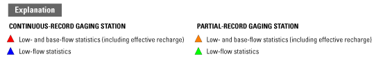
| [Latitude and longitude are reported in degrees, minutes, and seconds; PR, partial-record gaging station; CR, continuous-record gaging station; mi2, square mile; ft3/s, cubic foot per second; in/yr, inch per year; Q50, Q90, and Q95, indicate the 50-, 90-, and 95-percent discharge on the streamflow-duration curve, respectively; 7Q2 and 7Q10, indicate the annual minimum average 7-consecutive-day low-flow discharge having 2-year and 10-year recurrence intervals, respectively; nd indicates value was not determined] |
| AccessibilityFOIAPrivacyPolicies and Notices | |
 |
|