USGS - science for a changing world

Virginia Water Science Center

  home   information/data   projects   publications  about us [an error occurred while processing this directive]   internal
outreach1

Volunteering and Employment

USGS Volunteers for Science:

Student employment and volunteer opportunities:

Employment with the USGS:

Educational Resources from other Agencies

U.S. Fish and Wildlife Service:

National Parks Service:

National Aeronautics and Space Administration (NASA):

National Oceanic and Atmospheric Administration (NOAA):

U. S. Environmental Protection Agency Chesapeake Bay Program:

U.S. Department of Agriculture:

U.S. Department of Agriculture, NRCS:

Virginia Division of Mines, Minerals, and Energy:

Virginia Department of Conservation and Recreation:

Virginia Department of Environmental Quality:

Virginia Department of Forestry:


Virginia Water Science Center Outreach

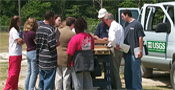
Outreach Events in Virginia

Virginia Water Monitoring Day

Science Center Participation in Outside Events

  • November 19, 2011: Kid's Tech University, Virginia State University (VSU), Petersburg, Virginia
  • September 19, 2011: World Water Monitoring Day (WWMD), Hains Point, Washington, D.C.
  • September 16, 2011: Cub Scout Pack XXX Meeting, at St. Michaels Church in Glen Allen, VA.

Technical Papers and Posters Presented

  • September 13, 2011: Growing Communities on Karst 2011 and the Great Valley Water Resources Forum, Shepherdstown, WV
  • September 10, 2011: The Diocesan "Water Sustainability Conference, Part II: Continuing the Dialogue
  • September 7, 2011: Smith Creek Partnership in Tenth Legion, VA

Guest Lecture Series

Several lectures typically are sponsored each year. No seminars or lectures are currently scheduled.

November 16, 2011: Dr. Christopher Magirl, U.S. Geological Survey, Tacoma, Washington:
“Geomorphic response of rivers downstream from retreating glaciers on Mount Rainier, Washington”

October 6, 2011: Dr. Ian Waite, U.S. Geological Survey, Portland, Oregon: “Application of Watershed Disturbance Models to Predict and Assess Biological Integrity of Stream Ecosystems”

Information Requests

Educational Materials VAWSC educational outreach

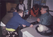
Featured Publications and Web Page

Regional Workshops and Seminars

  home   information/data   projects   publications  about us [an error occurred while processing this directive]   internal

USGS Home Water Climate Change Core Science Ecosystems Energy and Minerals Env. Health Hazards

Accessibility FOIA Privacy Policies and Notices

Take Pride in America logo USA.gov logo U.S. Department of the Interior | U.S. Geological Survey
URL: http://va.water.usgs.gov/outreach.html
Page Contact Information: webmaster-va@usgs.gov
Page Last Modified: Tuesday, 11-Apr-2017 15:11:30 EDT

02077000: Flow=258cfs,Stage=4.05ft,2024-02-26 18:00,<10,BANISTER RIVER AT HALIFAX, VA 02051000: Flow=22.2cfs,Stage=0.76ft,Floodstage=14ft,2024-02-26 18:45,<10,NORTH MEHERRIN RIVER NEAR LUNENBURG, VA 02013100: Flow=257cfs,Stage=4.67ft,Floodstage=17ft,2024-02-26 18:30,<10,JACKSON RIVER BL DUNLAP CREEK AT COVINGTON, VA 02011800: Flow=106cfs,Stage=8.54ft,2024-02-26 18:30,<10,JACKSON RIVER BL GATHRIGHT DAM NR HOT SPGS, VA 02011500: Flow=75.3cfs,Stage=2.94ft,Floodstage=8ft,2024-02-26 18:30,<10,BACK CREEK NEAR MOUNTAIN GROVE, VA 02011470: Flow=42.1cfs,Stage=4.40ft,Floodstage=8ft,2024-02-26 18:30,<10,BACK CREEK AT SUNRISE, VA 01670400: Flow=46.6cfs,Stage=3.72ft,2024-02-26 18:15,<10,NORTH ANNA RIVER NEAR PARTLOW, VA 01660400: Flow=16.8cfs,Stage=0.92ft,Floodstage=15ft,2024-02-26 18:30,<10,AQUIA CREEK NEAR GARRISONVILLE, VA 02079640: Flow=4.04cfs,Stage=3.88ft,Floodstage=15ft,2024-02-26 18:30,<10,ALLEN CREEK NEAR BOYDTON, VA 02077303: Flow=5.20cfs,Stage=3.81ft,2024-02-26 18:45,<10,HYCO R BL ABAY D NR MCGEHEES MILL, NC 01666500: Flow=65.8cfs,Stage=3.47ft,Floodstage=11ft,2024-02-26 18:45,<10,ROBINSON RIVER NEAR LOCUST DALE, VA 01656000: Flow=17.6cfs,Stage=2.45ft,Floodstage=12ft,2024-02-26 18:45,<10,CEDAR RUN NEAR CATLETT, VA 03209000: Flow=664cfs,Stage=3.93ft,2024-02-26 18:30,76-90,POUND RIVER BELOW FLANNAGAN DAM, NEAR HAYSI, VA 03208950: Flow=71.1cfs,Stage=2.71ft,Floodstage=11ft,2024-02-26 18:30,10-24,CRANES NEST RIVER NEAR CLINTWOOD, VA 03207800: Flow=302cfs,Stage=3.47ft,Floodstage=20ft,2024-02-26 18:30,10-24,LEVISA FORK AT BIG ROCK, VA 03176500: Flow=3970cfs,Stage=4.23ft,Floodstage=15ft,2024-02-26 18:30,10-24,NEW RIVER AT GLEN LYN, VA 03173000: Flow=208cfs,Stage=3.88ft,Floodstage=11ft,2024-02-26 18:30,10-24,WALKER CREEK AT BANE, VA 03171000: Flow=2730cfs,Stage=2.50ft,Floodstage=14ft,2024-02-26 18:15,10-24,NEW RIVER AT RADFORD, VA 03170000: Flow=227cfs,Stage=1.38ft,Floodstage=8ft,2024-02-26 18:15,10-24,LITTLE RIVER AT GRAYSONTOWN, VA 02080500: Flow=4070cfs,Stage=3.98ft,Floodstage=9ft,2024-02-26 18:45,10-24,ROANOKE RIVER AT ROANOKE RAPIDS, NC 02075500: Flow=1950cfs,Stage=4.33ft,Floodstage=22ft,2024-02-26 17:45,10-24,DAN RIVER AT PACES, VA 02074500: Flow=66.5cfs,Stage=1.37ft,Floodstage=8ft,2024-02-26 18:00,10-24,SANDY RIVER NEAR DANVILLE, VA 02065500: Flow=62.5cfs,Stage=1.70ft,Floodstage=12ft,2024-02-26 18:45,10-24,CUB CREEK AT PHENIX, VA 02064000: Flow=88.2cfs,Stage=3.08ft,Floodstage=15ft,2024-02-26 18:30,10-24,FALLING RIVER NEAR NARUNA, VA 02061500: Flow=244cfs,Stage=2.98ft,Floodstage=19ft,2024-02-26 18:45,10-24,BIG OTTER RIVER NEAR EVINGTON, VA 02059500: Flow=104cfs,Stage=1.46ft,Floodstage=15ft,2024-02-26 18:30,10-24,GOOSE CREEK NEAR HUDDLESTON, VA 02058400: Flow=258cfs,Stage=2.83ft,Floodstage=15ft,2024-02-26 18:00,10-24,PIGG RIVER NEAR SANDY LEVEL, VA 02056650: Flow=27.6cfs,Stage=2.78ft,2024-02-26 18:15,10-24,BACK CREEK NEAR DUNDEE, VA 02056000: Flow=351cfs,Stage=2.65ft,Floodstage=13ft,2024-02-26 18:45,10-24,ROANOKE RIVER AT NIAGARA, VA 02055000: Flow=221cfs,Stage=1.35ft,Floodstage=10ft,2024-02-26 18:50,10-24,ROANOKE RIVER AT ROANOKE, VA 02054500: Flow=144cfs,Stage=2.01ft,Floodstage=8ft,2024-02-26 18:50,10-24,ROANOKE RIVER AT LAFAYETTE, VA 02053800: Flow=69.4cfs,Stage=0.79ft,Floodstage=5ft,2024-02-26 18:50,10-24,S F ROANOKE RIVER NEAR SHAWSVILLE, VA 02052000: Flow=397cfs,Stage=4.53ft,Floodstage=23ft,2024-02-26 18:30,10-24,MEHERRIN RIVER AT EMPORIA, VA 02051500: Flow=236cfs,Stage=2.81ft,Floodstage=15ft,2024-02-26 18:45,10-24,MEHERRIN RIVER NEAR LAWRENCEVILLE, VA 02049500: Flow=527cfs,Stage=5.63ft,Floodstage=10.8ft,2024-02-26 17:45,10-24,BLACKWATER RIVER NEAR FRANKLIN, VA 02047500: Flow=251cfs,Stage=32.97ft,Floodstage=36.3ft,2024-02-26 18:45,10-24,BLACKWATER RIVER NEAR DENDRON, VA 02044500: Flow=191cfs,Stage=3.07ft,Floodstage=10ft,2024-02-26 18:50,10-24,NOTTOWAY RIVER NEAR RAWLINGS, VA 02037000: Flow=5.90cfs,Stage=4.49ft,2024-02-26 18:30,10-24,JAMES RIVER AND KANAWHA CANAL NEAR RICHMOND, VA 02036500: Flow=11.0cfs,Stage=1.87ft,2024-02-26 18:45,10-24,FINE CREEK AT FINE CREEK MILLS, VA 02035000: Flow=4990cfs,Stage=3.35ft,Floodstage=20ft,2024-02-26 17:45,10-24,JAMES RIVER AT CARTERSVILLE, VA 02030500: Flow=148cfs,Stage=3.44ft,Floodstage=12ft,2024-02-26 18:15,10-24,SLATE RIVER NEAR ARVONIA, VA 02029000: Flow=3720cfs,Stage=4.64ft,Floodstage=20ft,2024-02-26 18:15,10-24,JAMES RIVER AT SCOTTSVILLE, VA 02027000: Flow=109cfs,Stage=3.35ft,Floodstage=13ft,2024-02-26 18:45,10-24,TYE RIVER NEAR LOVINGSTON, VA 02026000: Flow=2700cfs,Stage=3.83ft,Floodstage=16ft,2024-02-26 18:30,10-24,JAMES RIVER AT BENT CREEK, VA 02025500: Flow=2020cfs,Stage=5.08ft,Floodstage=22ft,2024-02-26 18:45,10-24,JAMES RIVER AT HOLCOMB ROCK, VA 02024000: Flow=370cfs,Stage=2.12ft,Floodstage=17ft,2024-02-26 18:40,10-24,MAURY RIVER NEAR BUENA VISTA, VA 02022500: Flow=17.8cfs,Stage=2.88ft,Floodstage=8ft,2024-02-26 18:45,10-24,KERRS CREEK NEAR LEXINGTON, VA 02021500: Flow=176cfs,Stage=1.71ft,Floodstage=10ft,2024-02-26 18:00,10-24,MAURY RIVER AT ROCKBRIDGE BATHS, VA 02020500: Flow=83.2cfs,Stage=1.99ft,Floodstage=12ft,2024-02-26 18:45,10-24,CALFPASTURE RIVER ABOVE MILL CREEK AT GOSHEN, VA 02019500: Flow=1290cfs,Stage=3.18ft,Floodstage=17.00ft,2024-02-26 18:00,10-24,JAMES RIVER AT BUCHANAN, VA 02018500: Flow=12.9cfs,Stage=2.28ft,Floodstage=7ft,2024-02-26 18:45,10-24,CATAWBA CREEK NEAR CATAWBA, VA 02018000: Flow=254cfs,Stage=4.42ft,Floodstage=12ft,2024-02-26 18:15,10-24,CRAIG CREEK AT PARR, VA 02017500: Flow=69.2cfs,Stage=3.51ft,Floodstage=10ft,2024-02-26 18:45,10-24,JOHNS CREEK AT NEW CASTLE, VA 02016500: Flow=684cfs,Stage=2.35ft,Floodstage=16ft,2024-02-26 18:00,10-24,JAMES RIVER AT LICK RUN, VA 02016000: Flow=262cfs,Stage=2.02ft,Floodstage=10ft,2024-02-26 18:30,10-24,COWPASTURE RIVER NEAR CLIFTON FORGE, VA 02015700: Flow=79.4cfs,Stage=1.54ft,Floodstage=8ft,2024-02-26 18:45,10-24,BULLPASTURE RIVER AT WILLIAMSVILLE, VA 02014000: Flow=110cfs,Stage=2.54ft,Floodstage=9ft,2024-02-26 18:30,10-24,POTTS CREEK NEAR COVINGTON, VA 02013000: Flow=95.8cfs,Stage=1.84ft,Floodstage=9ft,2024-02-26 18:30,10-24,DUNLAP CREEK NEAR COVINGTON, VA 02011460: Flow=48.7cfs,Stage=1.66ft,Floodstage=7ft,2024-02-26 18:00,10-24,BACK CREEK NEAR SUNRISE, VA 02011400: Flow=77.3cfs,Stage=3.49ft,Floodstage=10ft,2024-02-26 18:30,10-24,JACKSON RIVER NEAR BACOVA, VA 01674000: Flow=132cfs,Stage=3.54ft,Floodstage=11ft,2024-02-26 18:45,10-24,MATTAPONI RIVER NEAR BOWLING GREEN, VA 01673800: Flow=33.6cfs,Stage=1.98ft,2024-02-26 18:45,10-24,PO RIVER NEAR SPOTSYLVANIA, VA 01671100: Flow=58.4cfs,Stage=2.64ft,2024-02-26 18:45,10-24,LITTLE RIVER NEAR DOSWELL, VA 01671020: Flow=220cfs,Stage=4.36ft,2024-02-26 18:45,10-24,NORTH ANNA RIVER AT HART CORNER NEAR DOSWELL, VA 01668000: Flow=812cfs,Stage=2.53ft,Floodstage=13ft,2024-02-26 18:00,10-24,RAPPAHANNOCK RIVER NEAR FREDERICKSBURG, VA 01664000: Flow=446cfs,Stage=3.62ft,Floodstage=15ft,2024-02-26 18:15,10-24,RAPPAHANNOCK RIVER AT REMINGTON, VA 01662800: Flow=19.3cfs,Stage=1.62ft,Floodstage=11ft,2024-02-26 18:45,10-24,BATTLE RUN NEAR LAUREL MILLS, VA 01658500: Flow=3.68cfs,Stage=3.10ft,Floodstage=9ft,2024-02-26 18:15,10-24,S F QUANTICO CREEK NEAR INDEPENDENT HILL, VA 01654000: Flow=12.6cfs,Stage=1.76ft,Floodstage=9.5ft,2024-02-26 17:45,10-24,ACCOTINK CREEK NEAR ANNANDALE, VA 01653000: Flow=15.9cfs,Stage=3.91ft,Floodstage=9.5ft,2024-02-26 18:50,10-24,CAMERON RUN AT ALEXANDRIA, VA 01651800: Flow=1.60cfs,Stage=4.18ft,Floodstage=10ft,2024-02-26 18:38,10-24,WATTS BRANCH AT WASHINGTON, DC 01648000: Flow=36.0cfs,Stage=1.99ft,Floodstage=7ft,2024-02-26 18:15,10-24,ROCK CREEK AT SHERRILL DRIVE WASHINGTON, DC 01646000: Flow=35.0cfs,Stage=3.11ft,Floodstage=11ft,2024-02-26 18:15,10-24,DIFFICULT RUN NEAR GREAT FALLS, VA 01638480: Flow=50.4cfs,Stage=3.07ft,Floodstage=12ft,2024-02-26 18:30,10-24,CATOCTIN CREEK AT TAYLORSTOWN, VA 01629500: Flow=904cfs,Stage=2.78ft,Floodstage=14ft,2024-02-26 18:45,10-24,S F SHENANDOAH RIVER NEAR LURAY, VA 01626850: Flow=134cfs,Stage=2.63ft,Floodstage=11ft,2024-02-26 17:45,10-24,SOUTH RIVER NEAR DOOMS, VA 01620500: Flow=13.2cfs,Stage=2.11ft,2024-02-26 18:00,10-24,NORTH RIVER NEAR STOKESVILLE, VA 01607500: Flow=51.0cfs,Stage=1.79ft,Floodstage=10ft,2024-02-26 18:00,10-24,S F SOUTH BRANCH POTOMAC RIVER AT BRANDYWINE, WV 03532000: Flow=1460cfs,Stage=4.94ft,Floodstage=17ft,2024-02-26 18:15,25-75,POWELL RIVER NEAR ARTHUR, TN 03531500: Flow=574cfs,Stage=2.68ft,Floodstage=18ft,2024-02-26 18:45,25-75,POWELL RIVER NEAR JONESVILLE, VA 03529500: Flow=169cfs,Stage=2.74ft,Floodstage=10ft,2024-02-26 18:15,25-75,POWELL RIVER AT BIG STONE GAP, VA 03527000: Flow=2210cfs,Stage=5.21ft,Floodstage=18ft,2024-02-26 18:15,25-75,CLINCH RIVER AT SPEERS FERRY, VA 03524000: Flow=1010cfs,Stage=3.45ft,Floodstage=14ft,2024-02-26 18:45,25-75,CLINCH RIVER AT CLEVELAND, VA 03490000: Flow=1610cfs,Stage=4.01ft,Floodstage=12ft,2024-02-26 18:15,25-75,N F HOLSTON RIVER NEAR GATE CITY, VA 03488000: Flow=452cfs,Stage=1.96ft,Floodstage=10ft,2024-02-26 18:40,25-75,N F HOLSTON RIVER NEAR SALTVILLE, VA 03478400: Flow=57.3cfs,Stage=3.78ft,Floodstage=12ft,2024-02-26 18:45,25-75,BEAVER CREEK AT BRISTOL, VA 03475000: Flow=380cfs,Stage=3.01ft,Floodstage=14ft,2024-02-26 18:44,25-75,M F HOLSTON RIVER NEAR MEADOWVIEW, VA 03474000: Flow=287cfs,Stage=1.92ft,Floodstage=8ft,2024-02-26 18:40,25-75,M F HOLSTON RIVER AT SEVEN MILE FORD, VA 03473000: Flow=826cfs,Stage=4.11ft,Floodstage=19.5ft,2024-02-26 18:45,25-75,S F HOLSTON RIVER NEAR DAMASCUS, VA 03471500: Flow=159cfs,Stage=2.05ft,Floodstage=7ft,2024-02-26 18:44,25-75,S F HOLSTON RIVER AT RIVERSIDE, NEAR CHILHOWIE, VA 03213500: Flow=25.3cfs,Stage=3.14ft,Floodstage=10ft,2024-02-26 18:00,25-75,PANTHER CREEK NEAR PANTHER, WV 03212980: Flow=221cfs,Stage=3.64ft,Floodstage=10ft,2024-02-26 18:00,25-75,DRY FORK AT BEARTOWN, WV 03208500: Flow=336cfs,Stage=3.06ft,Floodstage=16ft,2024-02-26 18:45,25-75,RUSSELL FORK AT HAYSI, VA 03177710: Flow=80.6cfs,Stage=2.20ft,Floodstage=7ft,2024-02-26 18:45,25-75,BLUESTONE RIVER AT FALLS MILLS, VA 03175500: Flow=267cfs,Stage=3.80ft,Floodstage=10ft,2024-02-26 18:30,25-75,WOLF CREEK NEAR NARROWS, VA 03168000: Flow=2880cfs,Stage=2.16ft,Floodstage=8ft,2024-02-26 18:30,25-75,NEW RIVER AT ALLISONIA, VA 03167000: Flow=266cfs,Stage=2.00ft,Floodstage=6.5ft,2024-02-26 18:00,25-75,REED CREEK AT GRAHAMS FORGE, VA 03165500: Flow=1990cfs,Stage=3.23ft,Floodstage=16ft,2024-02-26 18:50,25-75,NEW RIVER AT IVANHOE, VA 03165000: Flow=65.8cfs,Stage=1.58ft,Floodstage=7.00ft,2024-02-26 18:00,25-75,CHESTNUT CREEK AT GALAX, VA 03164000: Flow=1700cfs,Stage=1.75ft,Floodstage=9ft,2024-02-26 18:30,25-75,NEW RIVER NEAR GALAX, VA 02077670: Flow=27.0cfs,Stage=2.49ft,Floodstage=8ft,2024-02-26 18:45,25-75,MAYO CR NR BETHEL HILL, NC 02074000: Flow=494cfs,Stage=2.56ft,Floodstage=12ft,2024-02-26 18:00,25-75,SMITH RIVER AT EDEN, NC 02073000: Flow=332cfs,Stage=2.19ft,Floodstage=11ft,2024-02-26 18:45,25-75,SMITH RIVER AT MARTINSVILLE, VA 02072500: Flow=335cfs,Stage=2.15ft,2024-02-26 18:00,25-75,SMITH RIVER AT BASSETT, VA 02072000: Flow=272cfs,Stage=3.17ft,2024-02-26 18:15,25-75,SMITH RIVER NEAR PHILPOTT, VA 02070500: Flow=276cfs,Stage=1.65ft,Floodstage=8ft,2024-02-26 18:45,25-75,MAYO RIVER NEAR PRICE, NC 02070000: Flow=101cfs,Stage=1.79ft,Floodstage=8ft,2024-02-26 18:45,25-75,NORTH MAYO RIVER NEAR SPENCER, VA 02069700: Flow=103cfs,Stage=3.92ft,Floodstage=12ft,2024-02-26 18:45,25-75,SOUTH MAYO RIVER NEAR NETTLERIDGE, VA 02068500: Flow=168cfs,Stage=1.74ft,Floodstage=13ft,2024-02-26 18:30,25-75,DAN RIVER NEAR FRANCISCO, NC 02066000: Flow=1980cfs,Stage=7.54ft,Floodstage=24ft,2024-02-26 17:45,25-75,ROANOKE (STAUNTON) RIVER AT RANDOLPH, VA 02062500: Flow=1530cfs,Stage=5.23ft,Floodstage=23ft,2024-02-26 17:45,25-75,ROANOKE (STAUNTON) RIVER AT BROOKNEAL, VA 02060500: Flow=1240cfs,Stage=2.53ft,Floodstage=18ft,2024-02-26 18:00,25-75,ROANOKE RIVER AT ALTAVISTA, VA 02056900: Flow=92.7cfs,Stage=2.24ft,Floodstage=12ft,2024-02-26 18:45,25-75,BLACKWATER RIVER NEAR ROCKY MOUNT, VA 02055100: Flow=9.65cfs,Stage=1.38ft,Floodstage=11ft,2024-02-26 18:45,25-75,TINKER CREEK NEAR DALEVILLE, VA 02054530: Flow=167cfs,Stage=2.72ft,Floodstage=9ft,2024-02-26 18:15,25-75,ROANOKE RIVER AT GLENVAR, VA 02047000: Flow=1340cfs,Stage=8.57ft,Floodstage=16ft,2024-02-26 18:15,25-75,NOTTOWAY RIVER NEAR SEBRELL, VA 02046000: Flow=103cfs,Stage=2.12ft,2024-02-26 18:45,25-75,STONY CREEK NEAR DINWIDDIE, VA 02045500: Flow=471cfs,Stage=4.67ft,Floodstage=15ft,2024-02-26 18:30,25-75,NOTTOWAY RIVER NEAR STONY CREEK, VA 02042500: Flow=230cfs,Stage=4.83ft,Floodstage=9ft,2024-02-26 18:00,25-75,CHICKAHOMINY RIVER NEAR PROVIDENCE FORGE, VA 02041650: Flow=1180cfs,Stage=3.72ft,Floodstage=10ft,2024-02-26 17:45,25-75,APPOMATTOX RIVER AT MATOACA, VA 02041000: Flow=111cfs,Stage=2.20ft,2024-02-26 18:30,25-75,DEEP CREEK NEAR MANNBORO, VA 02040000: Flow=514cfs,Stage=9.16ft,Floodstage=21ft,2024-02-26 18:30,25-75,APPOMATTOX RIVER AT MATTOAX, VA 02039500: Flow=197cfs,Stage=5.17ft,Floodstage=16ft,2024-02-26 18:50,25-75,APPOMATTOX RIVER AT FARMVILLE, VA 02039000: Flow=61.2cfs,Stage=1.69ft,2024-02-26 18:30,25-75,BUFFALO CREEK NEAR HAMPDEN SYDNEY, VA 02038850: Flow=6.08cfs,Stage=1.14ft,2024-02-26 17:45,25-75,HOLIDAY CREEK NEAR ANDERSONVILLE, VA 02037500: Flow=5710cfs,Stage=5.30ft,Floodstage=12ft,2024-02-26 18:00,25-75,JAMES RIVER NEAR RICHMOND, VA 02034000: Flow=514cfs,Stage=3.25ft,Floodstage=17ft,2024-02-26 18:50,25-75,RIVANNA RIVER AT PALMYRA, VA 02032250: Flow=65.4cfs,Stage=3.55ft,Floodstage=14ft,2024-02-26 17:45,25-75,MOORMANS RIVER NEAR FREE UNION, VA 02031000: Flow=75.8cfs,Stage=4.75ft,Floodstage=11ft,2024-02-26 18:45,25-75,MECHUMS RIVER NEAR WHITE HALL, VA 02030000: Flow=95.8cfs,Stage=2.79ft,2024-02-26 18:45,25-75,HARDWARE RIVER BL BRIERY RUN NR SCOTTSVILLE, VA 02028500: Flow=120cfs,Stage=3.22ft,Floodstage=12ft,2024-02-26 18:45,25-75,ROCKFISH RIVER NEAR GREENFIELD, VA 02027500: Flow=73.4cfs,Stage=2.64ft,Floodstage=11ft,2024-02-26 18:45,25-75,PINEY RIVER AT PINEY RIVER, VA 02011490: Flow=5.10cfs,Stage=0.99ft,2024-02-26 18:45,25-75,LITTLE BACK CREEK NEAR SUNRISE, VA 01674500: Flow=482cfs,Stage=6.49ft,Floodstage=20ft,2024-02-26 18:45,25-75,MATTAPONI RIVER NEAR BEULAHVILLE, VA 01673550: Flow=20.7cfs,Stage=1.53ft,2024-02-26 18:45,25-75,TOTOPOTOMOY CREEK NEAR STUDLEY, VA 01673000: Flow=700cfs,Stage=6.13ft,2024-02-26 18:45,25-75,PAMUNKEY RIVER NEAR HANOVER, VA 01672500: Flow=283cfs,Stage=3.00ft,Floodstage=12ft,2024-02-26 18:45,25-75,SOUTH ANNA RIVER NEAR ASHLAND, VA 01669520: Flow=94.6cfs,Stage=5.38ft,2024-02-26 18:45,25-75,DRAGON SWAMP AT MASCOT, VA 01669000: Flow=33.9cfs,Stage=5.58ft,2024-02-26 18:45,25-75,PISCATAWAY CREEK NEAR TAPPAHANNOCK, VA 01667500: Flow=395cfs,Stage=1.25ft,Floodstage=13ft,2024-02-26 18:45,25-75,RAPIDAN RIVER NEAR CULPEPER, VA 01665500: Flow=111cfs,Stage=2.06ft,Floodstage=14ft,2024-02-26 18:45,25-75,RAPIDAN RIVER NEAR RUCKERSVILLE, VA 01663500: Flow=278cfs,Stage=4.03ft,Floodstage=16ft,2024-02-26 18:15,25-75,HAZEL RIVER AT RIXEYVILLE, VA 01658000: Flow=49.2cfs,Stage=2.65ft,Floodstage=7ft,2024-02-26 18:50,25-75,MATTAWOMAN CREEK NEAR POMONKEY, MD 01653600: Flow=34.9cfs,Stage=2.86ft,Floodstage=11.5ft,2024-02-26 18:30,25-75,PISCATAWAY CREEK AT PISCATAWAY, MD 01652500: Flow=7.94cfs,Stage=4.14ft,Floodstage=12ft,2024-02-26 18:50,25-75,FOURMILE RUN AT ALEXANDRIA, VA 01646500: Flow=17200cfs,Stage=4.66ft,Floodstage=10ft,2024-02-26 18:45,25-75,POTOMAC RIVER NEAR WASH, DC LITTLE FALLS PUMP STA 01645000: Flow=117cfs,Stage=2.31ft,Floodstage=7.5ft,2024-02-26 18:50,25-75,SENECA CREEK AT DAWSONVILLE, MD 01644000: Flow=238cfs,Stage=2.12ft,Floodstage=12ft,2024-02-26 17:45,25-75,GOOSE CREEK NEAR LEESBURG, VA 01643700: Flow=109cfs,Stage=2.96ft,Floodstage=13ft,2024-02-26 18:45,25-75,GOOSE CREEK NEAR MIDDLEBURG, VA 01643500: Flow=67.7cfs,Stage=1.85ft,Floodstage=11ft,2024-02-26 18:45,25-75,BENNETT CREEK AT PARK MILLS, MD 01638500: Flow=15500cfs,Stage=4.75ft,Floodstage=16ft,2024-02-26 18:45,25-75,POTOMAC RIVER AT POINT OF ROCKS, MD 01636500: Flow=2250cfs,Stage=3.16ft,Floodstage=10ft,2024-02-26 18:30,25-75,SHENANDOAH RIVER AT MILLVILLE, WV 01635500: Flow=59.1cfs,Stage=3.77ft,Floodstage=9ft,2024-02-26 18:45,25-75,PASSAGE CREEK NEAR BUCKTON, VA 01634500: Flow=83.5cfs,Stage=2.39ft,2024-02-26 18:45,25-75,CEDAR CREEK NEAR WINCHESTER, VA 01634000: Flow=482cfs,Stage=2.54ft,Floodstage=17ft,2024-02-26 18:30,25-75,N F SHENANDOAH RIVER NEAR STRASBURG, VA 01633000: Flow=255cfs,Stage=3.14ft,Floodstage=13ft,2024-02-26 18:45,25-75,N F SHENANDOAH RIVER AT MOUNT JACKSON, VA 01632900: Flow=60.2cfs,Stage=1.70ft,Floodstage=8ft,2024-02-26 18:00,25-75,SMITH CREEK NEAR NEW MARKET, VA 01632082: Flow=28.1cfs,Stage=1.61ft,Floodstage=14ft,2024-02-26 18:45,25-75,LINVILLE CREEK AT BROADWAY, VA 01632000: Flow=117cfs,Stage=3.16ft,Floodstage=15ft,2024-02-26 18:15,25-75,N F SHENANDOAH RIVER AT COOTES STORE, VA 01631000: Flow=1390cfs,Stage=1.97ft,Floodstage=12ft,2024-02-26 18:15,25-75,S F SHENANDOAH RIVER AT FRONT ROYAL, VA 01628500: Flow=786cfs,Stage=3.17ft,Floodstage=16ft,2024-02-26 18:45,25-75,S F SHENANDOAH RIVER NEAR LYNNWOOD, VA 01627500: Flow=192cfs,Stage=2.53ft,Floodstage=9.5ft,2024-02-26 18:45,25-75,SOUTH RIVER AT HARRISTON, VA 01626000: Flow=111cfs,Stage=2.83ft,Floodstage=9.5ft,2024-02-26 18:15,25-75,SOUTH RIVER NEAR WAYNESBORO, VA 01625000: Flow=213cfs,Stage=3.88ft,Floodstage=12ft,2024-02-26 18:15,25-75,MIDDLE RIVER NEAR GROTTOES, VA 01622000: Flow=256cfs,Stage=2.56ft,Floodstage=11ft,2024-02-26 17:45,25-75,NORTH RIVER NEAR BURKETOWN, VA 01615000: Flow=32.8cfs,Stage=4.56ft,Floodstage=10ft,2024-02-26 18:30,25-75,OPEQUON CREEK NEAR BERRYVILLE, VA 01613900: Flow=11.4cfs,Stage=0.80ft,Floodstage=8ft,2024-02-26 18:30,25-75,HOGUE CREEK NEAR HAYFIELD, VA 0317159760: Stage=2.48ft,2024-02-26 18:40,Not ranked,LITTLE STONY CREEK BL ARCHER TRAIL NR PEMBROKE, VA 0317154954: Stage=2.18ft,2024-02-26 18:00,Not ranked,SINKING CREEK ALONG ROUTE 604 NEAR NEWPORT, VA 0207730290: Stage=371.55ft,2024-02-26 18:45,Not ranked,AFTERBAY RESERVOIR AT DAM NR MCGEHEES MILL, NC 0205696095: Stage=2.41ft,2024-02-26 18:00,Not ranked,BLACKWATER RIVER BELOW MAPLE BRANCH NR REDWOOD, VA 0205551460: Flow=5.86cfs,Stage=2.84ft,2024-02-26 18:35,Not ranked,LICK RUN ABOVE PATTON AVENUE AT ROANOKE, VA 0205373422: Stage=1.38ft,2024-02-26 18:00,Not ranked,BOTTOM CREEK BL POOR MTN RD NEAR BENT MOUNTAIN, VA 0205373075: Stage=1.45ft,2024-02-26 18:00,Not ranked,BOTTOM CREEK ALONG ROUTE 612 NR BENT MOUNTAIN, VA 0204309906: Flow=0.78cfs,Stage=0.23ft,2024-02-26 18:25,Not ranked,CONVEYANCE CHAN AT RAMSGATE LN NR GREAT BRIDGE, VA 0204306533: Stage=3.20ft,2024-02-26 18:10:00,Not ranked,Equipment malfunction,STORM DRAIN AT LUDLOW DRIVE NEAR KEMPSVILLE, VA 0204300267: Stage=0.59ft,Floodstage=1.8ft,2024-02-26 18:48,Not ranked,BEGGARS BRIDGE CREEK NEAR DAWLEY CORNERS, VA 0204297575: Stage=0.20ft,2024-02-26 18:48,Not ranked,LAKE RUDEE NEAR BELLS ROAD AT VIRGINIA BEACH, VA 0204295505: Stage=-0.82ft,2024-02-26 18:48,Not ranked,LITTLE NECK CREEK AT PINEWOOD RD AT VA BEACH, VA 0204295063: Flow=0.01cfs,Stage=0.05ft,2024-02-26 18:05,Not ranked,STORM DRAIN AT LINDSLEY DR NEAR VIRGINIA BEACH, VA 0204293125: Stage=-0.70ft,2024-02-26 18:48,Not ranked,LONDON BRIDGE CREEK AT RT 58 AT VIRGINIA BEACH, VA 0204291317: Stage=-0.85ft,2024-02-26 18:48,Not ranked,THALIA CREEK AT ROUTE 58 AT THALIA, VA 0204289994: Stage=-0.28ft,Floodstage=2.80ft,2024-02-26 18:48,Not ranked,JAMES RIVER AT FORT MONROE, VA 0204289989: Flow=0.09cfs,2024-02-26 17:50,Stage=1.59ft,2024-02-26 18:50:00,Not ranked,STORM DRAIN AT SHEPPARD AVENUE NEAR NORFOLK, VA 0204289985: Stage=-0.21ft,Floodstage=2.80ft,2024-02-26 18:48,Not ranked,HAMPTON RIVER AT ROUTE 351 AT HAMPTON, VA 0204289402: Flow=0.02cfs,Stage=0.29ft,2024-02-26 18:30,Not ranked,STORM DRAIN AT CRANEYBROOK LANE AT EDGEFIELD, VA 0204289131: Flow=0.31cfs,Stage=1.02ft,2024-02-26 18:30,Not ranked,STORM DRAIN AT DAISY DRIVE NEAR PORTSMOUTH, VA 0204288905: Stage=-0.72ft,2024-02-26 18:48,Not ranked,BAILEY CREEK AT DOCK LANDING RD AT CHESAPEAKE, VA 0204288786: Stage=0.60ft,2024-02-26 18:45:00,Not ranked,Equipment malfunction,STORM DRAIN AT PROFESSIONAL PL NEAR CHESAPEAKE, VA 0204288771: Flow=0.05cfs,2024-02-26 17:55,Stage=0.16ft,2024-02-26 18:55:00,Not ranked,STORM DRAIN AT USAA DRIVE AT NORFOLK, VA 0204288721: Stage=-0.76ft,2024-02-26 18:48,Not ranked,EB ELIZABETH RIVER AT RT 165 AT VIRGINIA BEACH, VA 0204288539: Stage=-0.87ft,2024-02-26 18:48,Not ranked,BELLS MILL CRK AT BELLS MILL RD AT CHESAPEAKE, VA 0204279294: Flow=0.01cfs,Stage=0.07ft,2024-02-26 18:45,Not ranked,STORM DRAIN AT LAKEWOOD PK DR NR NEWPORT NEWS, VA 0204279245: Flow=0.09cfs,Stage=0.13ft,2024-02-26 18:45,Not ranked,STORM DRAIN AT RIVERS RDG CIR NR NEWPORT NEWS, VA 0167892964: Stage=-0.38ft,2024-02-26 18:48,Not ranked,NEWMARKET CREEK AT MERCURY BLVD AT HAMPTON, VA 0167891721: Flow=0.03cfs,Stage=0.12ft,2024-02-26 18:50,Not ranked,STORM DRAIN AT COLISEUM DRIVE AT HAMPTON, VA 0167889257: Flow=0.00cfs,Stage=0.22ft,2024-02-26 18:20,Not ranked,STORM DRAIN WEST OF GARRETT DRIVE AT HAMPTON, VA 0167862550: Stage=-0.34ft,2024-02-26 18:48,Not ranked,BRICK KILN CREEK BELOW ROUTE 172 NEAR POQUOSON, VA 0167357970: Flow=17.2cfs,Stage=5.20ft,2024-02-26 18:15,Not ranked,MONCUIN CREEK BELOW US HWY 360 NEAR MANQUIN, VA 0165258890: Stage=1.61ft,Floodstage=3.3ft,2024-02-26 18:48,Not ranked,POTOMAC RIVER AT CAMERON ST DOCK AT ALEXANDRIA, VA 03527220: Flow=2490cfs,Stage=4.12ft,2024-02-26 18:15,Not ranked,CLINCH RIVER NEAR LOONEYS GAP, TN 03277300: Stage=1.94ft,2024-02-26 18:15:00,Floodstage=10ft,Not ranked,Rating being developed or revised,NORTH FORK KENTUCKY RIVER AT WHITESBURG, KY 03209200: Stage=8.90ft,Floodstage=15ft,2024-02-26 18:00,Not ranked,RUSSELL FORK AT BARTLICK, VA 03182888: Stage=46.79ft,2024-02-26 18:45,Not ranked,DRY CREEK AT TUCKAHOE, WV 03178150: Stage=22.18ft,2024-02-26 18:00,Not ranked,MIDDLE FORK BRUSH CREEK AT EDISON, WV 03170500: Stage=1771.89ft,2024-02-26 18:30,Not ranked,LITTLE RIVER RESERVOIR NEAR RADFORD, VA 02079500: Stage=3.55ft,2024-02-26 18:15,Not ranked,ROANOKE RIVER AT BUGGS ISLAND, VA 02079490: Stage=298.36ft,Floodstage=320ft,2024-02-26 18:15,Not ranked,JOHN H. KERR RESERVOIR AT DAM NEAR BOYDTON, VA 02079241: Stage=258.02ft,2024-02-26 18:15,Not ranked,ISLAND CREEK RESERVOIR AT DAM NEAR CLARKSVILLE, VA 02077280: Stage=10.52ft,2024-02-26 18:45,Not ranked,HYCO LAKE AT DAM NR ROXBORO, NC 02076000: Flow=2010cfs,Stage=8.21ft,Floodstage=22ft,2024-02-26 18:00,Not ranked,DAN RIVER AT SOUTH BOSTON, VA 02075045: Flow=1420cfs,Stage=5.63ft,Floodstage=21ft,2024-02-26 17:45,Not ranked,DAN RIVER AT STP NEAR DANVILLE, VA 02071900: Stage=973.52ft,2024-02-26 17:45,Not ranked,PHILPOTT RES AT PHILPOTT DAM NR PHILPOTT, VA 02071530: Flow=40.4cfs,Stage=2.57ft,Floodstage=9ft,2024-02-26 18:45,Not ranked,SMITH RIVER AT SMITH RIV CHURCH NR WOOLWINE, VA 02052090: Flow=521cfs,Stage=5.47ft,2024-02-26 17:45,Not ranked,MEHERRIN RIVER NEAR BRYANTS CORNER, VA 02051190: Flow=117cfs,Stage=4.20ft,2024-02-26 17:45,Not ranked,MEHERRIN RIVER AT RT 637 NEAR SOUTH HILL, VA 02050000: Flow=413cfs,Stage=0.87ft,Floodstage=5ft,2024-02-26 18:15,Not ranked,BLACKWATER RIVER AT HWYS 58/258 AT FRANKLIN, VA 02047783: Flow=397cfs,Stage=18.29ft,Floodstage=23ft,2024-02-26 17:45,Not ranked,BLACKWATER RIVER AT ROUTE 620 NEAR ZUNI, VA 02047370: Flow=391cfs,Stage=1.57ft,2024-02-26 18:30,Not ranked,NOTTOWAY RIVER NEAR RIVERDALE, VA 02045320: Flow=383cfs,Stage=1.58ft,Floodstage=12.5ft,2024-02-26 17:45,Not ranked,NOTTOWAY RIVER AT ROUTE 609 NEAR MCKENNEY, VA 02043390: Stage=0.70ft,2024-02-26 18:48,Not ranked,NORTHWEST RIVER AT RT 168 NEAR NORTHWEST, VA 02043269: Stage=0.89ft,Floodstage=2ft,2024-02-26 18:48,Not ranked,NORTH LANDING RIVER AT MARINA NEAR CREEDS, VA 02043155: Stage=-0.42ft,2024-02-26 18:48,Not ranked,WEST NECK CREEK AT DAM NECK ROAD AT MAPLETON, VA 02042893: Stage=-0.64ft,Floodstage=5ft,2024-02-26 18:48,Not ranked,WB ELIZABETH RIVER AT ROUTE 17 NEAR PORTSMOUTH, VA 02042822: Stage=-1.20ft,Floodstage=3.59ft,2024-02-26 18:48,Not ranked,NANSEMOND RIVER AT ROUTE 460 AT SUFFOLK, VA 02042770: Stage=-0.28ft,Floodstage=2.89ft,2024-02-26 18:00,Not ranked,JAMES RIVER AT JAMESTOWN FERRY PIER, VA 02040892: Flow=758cfs,Stage=4.10ft,2024-02-26 18:00,Not ranked,APPOMATTOX RIVER AT ROUTE 602 NEAR MANNBORO, VA 02037705: Stage=2.15ft,Floodstage=8ft,2024-02-26 17:54,Not ranked,JAMES RIVER AT CITY LOCKS AT RICHMOND, VA 02032640: Flow=76.7cfs,Stage=5.63ft,Floodstage=14ft,2024-02-26 18:45,Not ranked,N F RIVANNA RIVER NEAR EARLYSVILLE, VA 02032515: Flow=197cfs,Stage=3.09ft,2024-02-26 18:45,Not ranked,S F RIVANNA RIVER NEAR CHARLOTTESVILLE, VA 02025652: Flow=24.9cfs,Stage=3.86ft,2024-02-26 18:00,Not ranked,HARRIS CREEK BELOW ROUTE 130 NEAR MONROE, VA 02024915: Flow=29.3cfs,Stage=3.17ft,2024-02-26 18:45,Not ranked,PEDLAR RIVER AT FOREST ROAD NEAR BUENA VISTA, VA 02024752: Flow=2220cfs,Stage=4.83ft,2024-02-26 17:45,Not ranked,JAMES RIVER AT BLUE RIDGE PKWY NR BIG ISLAND, VA 02024750: Stage=5.58ft,2024-02-26 18:15,Not ranked,JAMES RIVER AT BEDFORD DAM NR MAJOR, VA 01674182: Flow=29.9cfs,Stage=3.08ft,2024-02-26 18:30,Not ranked,POLECAT CREEK AT ROUTE 301 NEAR PENOLA, VA 01656903: Flow=1.51cfs,Stage=1.12ft,Floodstage=9ft,2024-02-26 18:00,Not ranked,FLATLICK BRANCH ABOVE FROG BRANCH AT CHANTILLY, VA 01654500: Flow=1.87cfs,Stage=2.65ft,2024-02-26 17:55,Not ranked,LONG BRANCH NEAR ANNANDALE, VA 01652545: Stage=0.51ft,Floodstage=7ft,2024-02-26 18:12,Not ranked,FOURMILE RUN ABOVE HIGHWAY 1 AT ALEXANDRIA, VA 01647600: Stage=0.68ft,Floodstage=3.74ft,2024-02-26 17:54,Not ranked,POTOMAC RIVER AT WISCONSIN AVE, WASHINGTON, DC 01646305: Flow=1.07cfs,Stage=1.26ft,Floodstage=9ft,2024-02-26 18:00,Not ranked,DEAD RUN AT WHANN AVENUE NEAR MCLEAN, VA 01645762: Flow=1.65cfs,Stage=0.29ft,2024-02-26 18:00,Not ranked,S F LITTLE DIFFICULT RUN ABOVE MOUTH NR VIENNA, VA 01645704: Flow=2.87cfs,Stage=0.99ft,2024-02-26 18:25,Not ranked,DIFFICULT RUN ABOVE FOX LAKE NEAR FAIRFAX, VA 01644280: Flow=45.4cfs,Stage=1.89ft,Floodstage=12ft,2024-02-26 18:40,Not ranked,BROAD RUN NEAR LEESBURG, VA 01643880: Flow=48.4cfs,Stage=1.86ft,Floodstage=10ft,2024-02-26 18:50,Not ranked,BEAVERDAM CREEK AT RT 734 NEAR MOUNTVILLE, VA 01643805: Flow=28.8cfs,Stage=2.09ft,Floodstage=10ft,2024-02-26 18:15,Not ranked,N F GOOSE CREEK AT RT 729 NEAR LINCOLN, VA 01643590: Flow=6.98cfs,Stage=0.62ft,Floodstage=7ft,2024-02-26 18:40,Not ranked,LIMESTONE BRANCH NEAR LEESBURG, VA 01638420: Flow=21.9cfs,Stage=2.18ft,Floodstage=10ft,2024-02-26 18:15,Not ranked,N F CATOCTIN CREEK AT RT 681 NEAR WATERFORD, VA 01638350: Flow=25.5cfs,Stage=1.34ft,Floodstage=8ft,2024-02-26 18:45,Not ranked,S F CATOCTIN CREEK AT RT 698 NEAR WATERFORD, VA 01636690: Flow=18.8cfs,Stage=2.07ft,Floodstage=9ft,2024-02-26 18:15,Not ranked,PINEY RUN NEAR LOVETTSVILLE, VA 01636464: Flow=19.8cfs,Stage=1.84ft,Floodstage=5.5ft,2024-02-26 18:30,Not ranked,BULLSKIN RUN BELOW KABLETOWN, WV 01636316: Flow=18.8cfs,Stage=1.84ft,Floodstage=12.5ft,2024-02-26 17:45,Not ranked,SPOUT RUN AT RT 621 NEAR MILLWOOD, VA 01621050: Flow=6.82cfs,Stage=2.72ft,Floodstage=8ft,2024-02-26 18:45,Not ranked,MUDDY CREEK AT MOUNT CLINTON, VA 01616100: Flow=7.09cfs,Stage=1.53ft,Floodstage=8ft,2024-02-26 18:15,Not ranked,DRY MARSH RUN NEAR BERRYVILLE, VA 01610400: Flow=19.9cfs,Stage=3.87ft,Floodstage=9.5ft,2024-02-26 18:00,Not ranked,WAITES RUN NEAR WARDENSVILLE, WV 01607300: Stage=46.74ft,2024-02-26 18:30,Not ranked,BRUSHY FORK NEAR SUGAR GROVE, WV 01484938: Stage=-0.74ft,Floodstage=2.97ft,2024-02-26 18:48,Not ranked,STARLING CREEK AT PORT OF SAXIS AT SAXIS, VA 01484812: Stage=-0.96ft,Floodstage=1.70ft,2024-02-26 18:48,Not ranked,NASSAWADOX CREEK AB CHURCH CRK NR SILVER BEACH, VA 01484746: Stage=-0.27ft,Floodstage=2.96ft,2024-02-26 18:00,Not ranked,CHINCOTEAGUE BAY INLET AT CHINCOTEAGUE, VA Go to WaterWatch (offsite) for a larger map with additional options