|
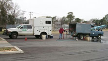 Well sampling
|
|
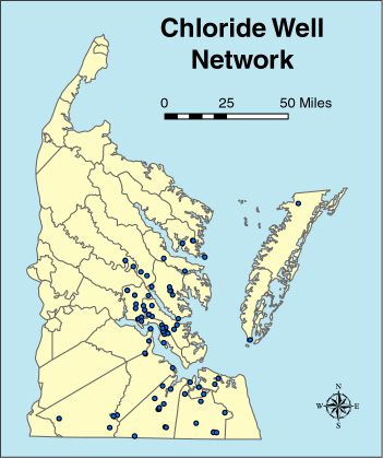
Chloride
Monitoring Network

Problem
Demands
for freshwater in the Coastal Plain of Virginia continue to increase. More
pumping wells are being added each year to supply present and future needs;
however, supplies of freshwater in some of the most productive aquifers--the
Cretaceous and early Tertiary aquifers--are limited by the presence of saltwater
which tends to increase with depth and to the east toward the Chesapeake Bay and
Atlantic Ocean. In fact, some
production wells are designed to pump slightly saline (brackish) water which is
then desalinated and mixed with water from other sources.
Information about the distribution of saline water in these aquifers and
an evaluation of the potential for intrusion or upcoming of saline water will
contribute to the wise management of the ground-water resources of the Coastal
Plain.
Objective
Objectives
of the program are to (1) evaluate the spatial and temporal distribution of
chloride concentrations in the aquifers, (2) evaluate the factors that affect
the spatial and temporal distributions of chloride, and (3) assess the
potential for upconing or lateral intrusion of saline water in the aquifers.
Relevance and Benefits
Information
about the distribution of saline water in these regional aquifers will aid in
evaluating the potential for intrusion or upconing of saline water. Information
about the general chemistry of the aquifers could provide further insights about
the origin of saltwater, which has impaired the availability of ground water in
the Coastal Plain of Virginia. Information gained through this project will
contribute to the wise long-term planning and management of the ground-water
resources of the Hampton Roads area.
Approach
A
multi-phase and multi-year systematic approach was proposed and initiated in
1995 by the Virginia District of the USGS. Major study components include (1) compilation and
preliminary analysis of existing chloride data, (2) compilation of additional
geologic, geophysical, hydraulic, and water-use information for aquifers and confining units with an emphasis on areas with
limited data and areas where concentrations of chloride are of greatest concern,
(3) evaluation of alternatives for obtaining additional data in areas of
insufficient data, (4) expansion and refinement of a long-term monitoring
program for salty ground water, and (5) analysis of the potential for upconing
and lateral movement of salty water.
|