USGS visual identity
Water Resources of Virginia

Seal of the City of Virginia Beach
Project

Title
Virginia Beach Shallow Ground-Water Study

Number
VA113

Location
Virginia Beach

Cooperating Agency
City of Virginia Beach Department of Public Utilities 

Project Chief
Barry Smith

Period of Project
1996 to present


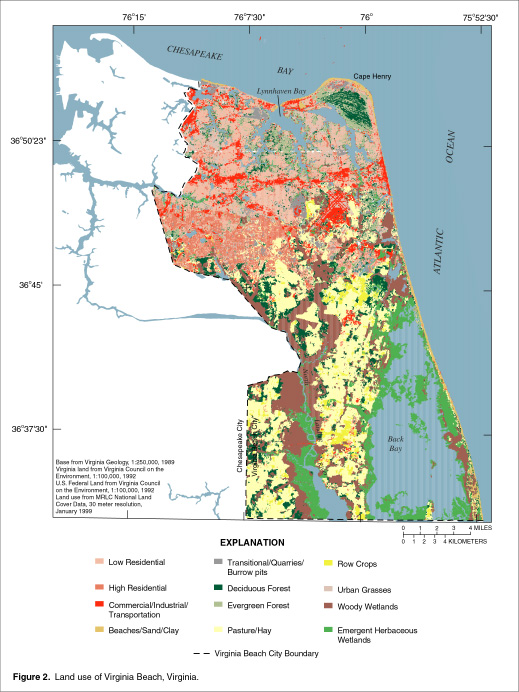
Virginia Beach: Land Use
graphic element

 
Virginia Beach Land Use


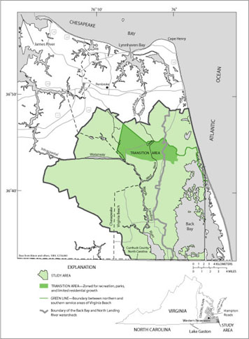
Virginia Beach Southern Watersheds
graphic element

 
Virginia Beach Southern Watersheds


Virginia Beach Shallow Aquifer System
graphic element

 
Virginia Beach Shallow Aquifer System


Virginia Beach Water-Level Network
graphic element

 
62A 5 62A 2 62A 3 62A 22 62A 23 62B 15 62B 16 62B 1 62B 2 62B 18 62B 22 62B 9 62B 24 62B 21 62B 8 62B 23 62C 5 61C 44 61C 43 62C 2 62C 3 62C 4 63C 5 62C 9 62C 12 62C 11 62C 10 62C 27 62C 27 62C 32 61C 33 61D 6 61D 9 61C 46 61C 45 61C 23 63C 20 62C 34 63C 11 62C 24 62C 15 62C 8 63C 19 63C 2 63C 3 Water-level network map


Virginia Beach Continuous-Record Wells
graphic element

61C 46 61C 43 62B 15 61C 44 62A 22 62B 16 62A 23Water-level network map


Virginia Projects or: Water Resources of Virginia
Contact:
GS-W-VArmd_webmaster@usgs.gov
U.S. Department of Interior, U.S. Geological Survey
Privacy Statement

Disclaimer
URL: http://va.water.usgs.gov/projects/va113.html
Last modified: Wednesday, March 10, 2004 09:48:17 AM