
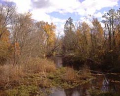
 Headwaters of Polecat Creek
|
 Downstream part of Polecat Creek |
Problem
Elevated
nutrients and suspended solids in the Chesapeake Bay adversely affect water
clarity and dissolved oxygen levels, stressing living resources in the Bay and its
tributaries. In 1987, the
Chesapeake Bay Agreement called for a 40% reduction in controllable nutrients
entering the Bay by the year 2000. In
2000, a renewed Chesapeake Bay agreement was created to reinforce and redefine
efforts toward these nutrient reductions. In
an effort to reduce nutrients and sediments entering the Bay, management
strategies have been implemented in tributary basins.
Evaluation of nutrient sources and transport are needed for assessing the success of
these strategies in improving water quality and living resource
response.
Objective
Assess
the effectiveness of best management practices in controlling the transport of
nutrients through ground water to streams in the Polecat Creek Watershed.
Relevance and Benefits
Results
of this study will improve the understanding of factors affecting the transport of nutrients
through shallow ground water to streams in similar Piedmont and Coastal
Plain geohydrologic environments throughout the Chesapeake Bay Watershed.
This understanding will help improve management strategies to control nutrient transport through
ground water to streams in similar environments throughout the watershed.
Approach
Clusters
of wells open to the surficial aquifer were installed along regional flow
paths in agricultural and residential land uses.
Sediment
obtained when the wells were installed is being used to evaluate the
characteristics of the aquifers and confining units. Ground-water quality and levels are monitored
periodically. Local studies are also being conducted to evaluate localized ground-water flow paths and hydrologic
and chemical processes that affect nutrient transport and discharge to streams.
This information will be used to: 1)
develop geohydrologic frameworks for representative areas;
2) develop conceptual ground-water flow models for representative areas;
3) assess the effectiveness of best management practices; and 4) assess
the effects of natural ground-water processes on nutrients in ground-water
discharging to the streams.