Colonial
National Historical Park

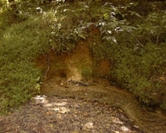 Springs discharging from the
Cornwallis Cave aquifer |
Problem
Surficial
aquatic habitats share an obvious and dependent relationship with the
ground-water system at Colonial National Historical Park (CNHP).
Consequently, successful management of park resources depends, in
part, on knowledge of the quantity and quality of ground-water discharge.
Because ground water in the park can be influenced by off-park
activities, the National Park Service (NPS) is concerned about activities
outside the park boundaries that could adversely impact park resources.
Specifically, the NPS is concerned about impacts that could degrade water
quality, change patterns of stream and spring flow, and/or endanger
water-dependent biological resources. In order to effectively manage park
water resources and minimize potential adverse impacts from outside park
boundaries, a more complete understanding of the behavior of the park’s
shallow aquifer system is needed. Specifically
knowledge is needed of:
-The
physical composition of the shallow aquifer system
-The
depth, thickness, and lateral extent of significant aquifers and confining
units
-The
boundaries of surface-water and ground-water flow systems that encompass the
park
-The ground-water recharge areas and general residence times
-The interaction between the
ground-water and surface-water systems
Objective
The
primary objective of this study wass to develop an understanding of hydrogeologic
framework and flow system of the Yorktown Battlefield shallow aquifer system to
the extent possible using existing information and limited non-intrusive data
collection methods. The secondary
objective was to identify significant gaps in local hydrogeologic information and
provide a well-defined scope of work for future studies to address these data
gaps.
Relevance and Benefits
Understanding
of the shallow ground water near the Yorktown Battlefield will help the National
Park Service, the Yorktown Naval Weapons Station, the town of Yorktown, and the
City of Newport News protect and manage the shallow ground-water system.
This understanding will help the Park Service evaluate whether changes in
water quantity or quality result from activities in the park or surrounding
areas and manage such effects on stream-water quality, wetlands, and
water-dependent biological resources.
Approach
Compiled
existing hydrogeologic data for the Yorktown Battlefield unit of the park and
surrounding areas.
Performed
a limited, non-intrusive hydrogeologic investigation of the park and its
adjacent areas based on evaluation of existing data.
Constructed a shallow hydrogeologic framework,
described aquifers and confining units, described general ground-water
quality, and
characterized the interaction between ground water and surface water.
Developed
GIS coverages of pertinent data locations
Prepared
a final report which, in addition to study results, includes project
statements and cost estimates for intrusive data needs and further
hydrogeologic characterization.
|

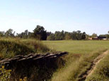 Yorktown Battlefield and visitor center