|
| |
 |
|
|
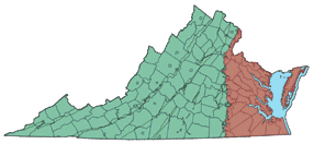
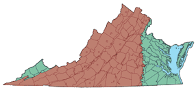
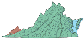
| The VAS study was divided into three sampling phases. Phase I sampling focused on the unconfined and confined aquifers of the Coastal Plain province. Phase II sampling focused on the fractured-rock aquifers in the Piedmont, Blue Ridge, and Valley & Ridge provinces. Phase III focused on the fractured rock and coal aquifers of the Appalachian Plateaus of southwestern Virginia. |
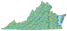
| Click on the individual maps below to view a listing of the sites sampled. |
|
|
Phase | Fiscal Year | Physiographic Province |
|
|
I | 1998 | Coastal Plain |
|
|
II | 1999 |
Piedmont, Blue Ridge, and Valley& Ridge |
|
|
III | 2000 | Appalachian Plateaus |
|
|
Final |
|
|
|
|
| Last Updated on 2/4/2002 By David L. Nelms |
Contact: GS-W-VArmd_webmaster@usgs.gov
U.S. Department of Interior,
U.S. Geological Survey
Privacy Statement
Disclaimer
Accessibility
URL http://va.water.usgs.gov/va123/5sites.html
Last update: 09/15/04 12:52