Virginia Water Science Center
|
DATA CENTER
|
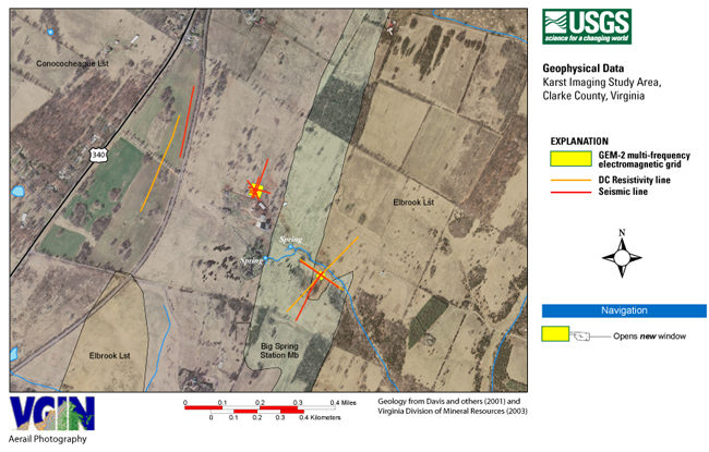
Karst Imaging Study Area
|
|
|
 The USGS provides current
("real-time")
stream
stage and streamflow, water-quality, and ground-water levels for 4 sites in
Clarke County, Va.
The USGS provides current
("real-time")
stream
stage and streamflow, water-quality, and ground-water levels for 4 sites in
Clarke County, Va.
 The USGS
and Virginia Department of Environmental Quality provide current
("real-time")
stream
stage and streamflow, water-quality, and ground-water levels for 35 sites in the Shenandoah Valley of Virginia and West Virginia.
The USGS
and Virginia Department of Environmental Quality provide current
("real-time")
stream
stage and streamflow, water-quality, and ground-water levels for 35 sites in the Shenandoah Valley of Virginia and West Virginia.

![]() U.S. Department of the Interior
| U.S. Geological Survey
U.S. Department of the Interior
| U.S. Geological Survey
URL: http://va.water.usgs.gov/clarke/GEOPH/KarstImg1.htm
Page Contact Information: webmaster-va@usgs.gov
Page Last Modified: 28-Feb-2008 14:00:00 EST