|
|
|
Shenandoah River
Instream Flow Studies

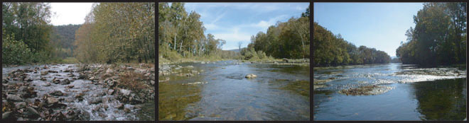
Problem
As
urban and rural growth continues, competition for clean water expands into
stream areas previously capable of meeting local water-use demands.
Conflicts among instream and offstream users of streamflow increase as
flows decrease.
Objective
The objectives of this research are to enhance understanding of summer low-flow conditions in the North Fork, South Fork, and Shenandoah Rivers, relate water availability to physical habitat needs of fish, and develop a relation for the availability of suitable fish habitat and instream flows.
Relevance and Benefits
As
a result of the study, the counties and communities in the Shenandoah Basin
should have a better knowledge of the water resources in the basin, the regional
hydraulic system, and the effect of withdrawals and conservation measures on the
ecology, agriculture, industry, and water supply.
The data and alternative condition analyses may be used for
identification and compilation of the major instream-flow issues, development of
the required multidisciplinary technical team to conduct more detailed studies,
and develop basin specific habitat and flow requirements for aquatic life and
water uses.
Approach
Flow data and biological data will be combined with depth and velocity of streamflow, cover type and bed-material size of numerous verticals at cross sections representing channel types. For the North Fork, hydraulic data were collected over a range of discharges by the USGS with the assistance of VPI. Hydraulic data were input to the RHABSIM model
(River Habitat Simulation Software), a 1-dimensional water-surface profile model that uses stage-discharge ratings to simulate habitat conditions over a range of discharges. The modeling was used to determine the relation between habitat and flow. This information along with offstream user needs will allow the planning district more efficient allocation of water resources.
Publications and Presentations
May 29, 2013
Shenandoah Water Supply Summit: Jen Krstolic and Alison Teetor
South Fork Shenandoah River Habitat-Flow Modeling to Determine Ecological and Recreational Characteristics during Low-Flow Periods
(pdf) 5517 KB
March 7, 2013
USGS Cooperative Water Stakeholder Webinar: Jen Krstolic with John Staelin and Alison Teetor
Ecological Flows in the Shenandoah River Valley, Virginia.
October 7, 2011
Federal News Radio Video about the Mainstem Shenandoah Research. Jen Krstolic and Roger Moberg
Cool Jobs: The Biogeographer
Shenandoah River Publications Summary:
Krstolic, J.L. and Ramey, R.C., 2012
South Fork Shenandoah River Habitat-Flow Modeling to Determine Ecological and Recreational Characteristics during Low-Flow Periods
Krstolic, J.L. and Hayes, D.C., 2010
GIS Data Release: Physical Habitat Characteristics on the North and South Forks of the Shenandoah River, VA in 2002-2007
Krstolic, J.L., Hayes, D.C., and Ruhl P.M., 2006
Physical habitat classification and instream flow modeling to determine habitat availability during low-flow periods, North Fork Shenandoah River, Virginia
Krstolic, J.L. and Hayes, D.C., 2004
Water-quality synoptic sampling, July 1999: North Fork Shenandoah River, Virginia
Zappia, H., and Hayes, D.C., 1998
A demonstration of the instream flow incremental methodology, Shenandoah River, Virginia
April 22, 2009
Regional Water Resources Policy Committee
Habitat
Suitability Criteria for Fishes of the South Fork of the Shenandoah River
(pdf) 588 KB
October 28, 2008
Shenandoah Water
Conference October 2008
(pdf) 1.3 MB
April 29-30, 2008
USGS-TNC Meeting: Regional-Scale
Streamflow-Ecology Relationships: A River Science Workshop.
(pdf) 89 KB
March 30, 2008
Presentation to Page County Citizens: DROUGHT – WATER
QUALITY AND WATER QUANTITY, March 30, 2008.
Are we Currently in a Drought?
What can the Instream Flow Study Results and other Drought Indices tell us?
(pdf) 1.7 MB
Instream Flow Studies in the
Shenandoah River Basin (pdf)
September 20, 2006
Joint Regional Water Resources Policy Committee and Technical Meeting
Instream Flow Studies in the
Shenandoah River Basin (pdf)
PUBLICATION: Physical
Habitat Classification and Instream Flow Modeling to Determine Habitat
Availability During Low-Flow Periods, North Fork Shenandoah River, Virginia
SIR 2006-5025.
June 7-8, 2005
Mid Atlantic Area Water Availability Workshop
University of Delaware Conference Center, Newark Delaware
Presentation with Alison Teetor
http://va.water.usgs.gov/delwkshp2005/index.htm
Accompanying Notes for USGS power point
North Fork Instream Flow Study Poster Presented at the Water Availability Workshop
"Habitat Availability During Low-Flow Periods on the North Fork Shenandoah River, Virginia"
March 2005
USGS power point presentation to the RWRPC Technical Advisory Committee
North Fork Shenandoah River Results Application For the State Drought
Assessment Plan
DEQ Drought Response Plan Documentation
http://www.deq.virginia.gov/waterresources/droughttac.html
December 2004
USGS Fact Sheet (unpublished) MS Word
North Fork Instream Flow Study overview and South Fork proposed work
October 25, 2004
USGS Powerpoint presentation to the RWRPC Technical Advisory Committee
North Fork Instream Flow Study overview and South Fork proposed work
September 2004
Report Published
Water-Quality Synoptic Sampling, July 1999: North Fork Shenandoah River, Virginia
http://pubs.usgs.gov/sir/2004/5153/
December 10, 2003
USGS Powerpoint
presentation to the MIF Technical Advisory Committee with accompanying
notes.
|