|

DATA CENTER
|
Geophysical Data for Warren County, Virginia--Surface Geophysics
| |
 |
 |
|
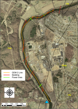
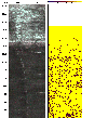
Location Map |
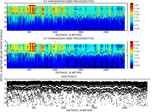
GEM-2 Pseudosection |
|
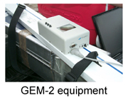
A multi-frequency domain electromagnetic (EM) conductivity survey was conducted along the South Fork Shenandoah River by towing a GEM-2 (photo inset) behind a canoe. Nearly 3,000 meters downstream of the USGS gaging station 01631000
 (blue triangle on location map) on
the South Fork was surveyed in less than two hours. The depth of penetration of the survey was approximately
20 meters. The hotter colors on the GEM-2 pseudosection
(above right) may indicate where ground water occurs at and/or below the streambed. Discrete areas of ground-discharge to streams in the Shenandoah Valley are common. (blue triangle on location map) on
the South Fork was surveyed in less than two hours. The depth of penetration of the survey was approximately
20 meters. The hotter colors on the GEM-2 pseudosection
(above right) may indicate where ground water occurs at and/or below the streambed. Discrete areas of ground-discharge to streams in the Shenandoah Valley are common. |
|
|
|
|
| |
|
|
 |
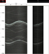
Warren County Borehole Logging data |
 |
Warren County
Geophysical data |
|
Additional
information on geophysical techniques used in hydrologic
investigations is available at the U.S. Geological
Survey, Office of Ground Water, Branch of Geophysics
(http://water.usgs.gov/ogw/bgas/)) |
|
|