Virginia Water Science Center

Clarke County Web site.

Search this site:

DATA CENTER

  • USGS IN YOUR STATE

    USGS Water Science Centers are located in each state.

    There is a USGS Water Science Center office in each State. Washington Oregon California Idaho Nevada Montana Wyoming Utah Colorado Arizona New Mexico North Dakota South Dakota Nebraska Kansas Oklahoma Texas Minnesota Iowa Missouri Arkansas Louisiana Wisconsin Illinois Mississippi Michigan Indiana Ohio Kentucky Tennessee Alabama Pennsylvania West Virginia Georgia Florida Caribbean Alaska Hawaii New York Vermont New Hampshire Maine Massachusettes South Carolina North Carolina Rhode Island Virginia Connecticut New Jersey Maryland-Delaware-D.C.

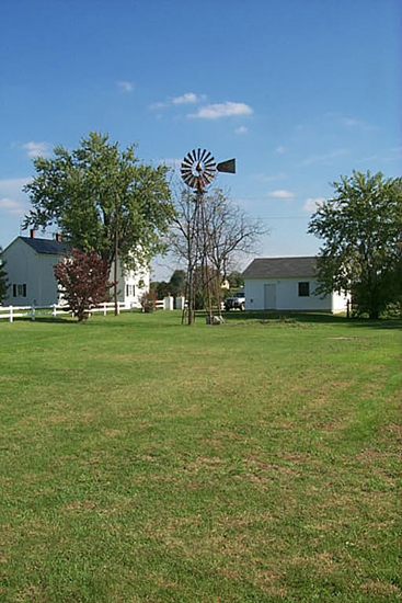
Photo Gallery for Clarke County, Virginia


Clarke Co. Photo GalleryClarke Co. Well Photo GalleryClarke Co. Age Dating Photo GalleryClarke Co. Field Methods Photo GalleryClarke Co. Geology Photo GalleryClarke Co. Geophysics Photo GalleryClarke Co. Panoramic Photo GalleryClarke Co. Springs Photo GalleryClarke Co. Streams Photo GalleryClarke Co. Wells Photo Gallery
 

Clarke County
Photo Gallery

Well

  Clarke County photograph well03.jpg
FILE:  well03.jpg  
DESCRIPTION:  
Well 46X122 is a drilled well that once was pumped by a windmill system. Photograph was taken from well 46X123, which is 420-feet deep with water entering the borehole at 290 feet. Water levels in these two wells are similar, which illustrates how connected the carbonate aquifers are to significant depths.  


SOURCE:
David Nelms
USGS
 
    Click for photograph well02.jpg Click for photograph well04.jpg

Current Water Conditions for Clarke Co.

Shaded relief map of Clarke County, Va.The USGS provides current ("real-time") stream stage and streamflow, water-quality, and ground-water levels for 4 sites in Clarke County, Va.

Current Water Conditions for the Shenandoah Valley

Shaded relief map of the Shenandoah Valley of Virginia and West VirginiaThe USGS provides current ("real-time") stream stage and streamflow, water-quality, and ground-water levels for 35 sites in the Shenandoah Valley of Virginia and West Virginia.

USGS Home Water Resources Biology Geography Geology Geospatial

Accessibility FOIA Privacy Policies and Notices

Take Pride in America logo FirstGov logo U.S. Department of the Interior | U.S. Geological Survey
URL: http://va.water.usgs.gov/clarke/PHOTO/Wells/well03.htm
Page Contact Information: webmaster-va@usgs.gov
Page Last Modified: 28-Feb-2008 14:00:00 EST